
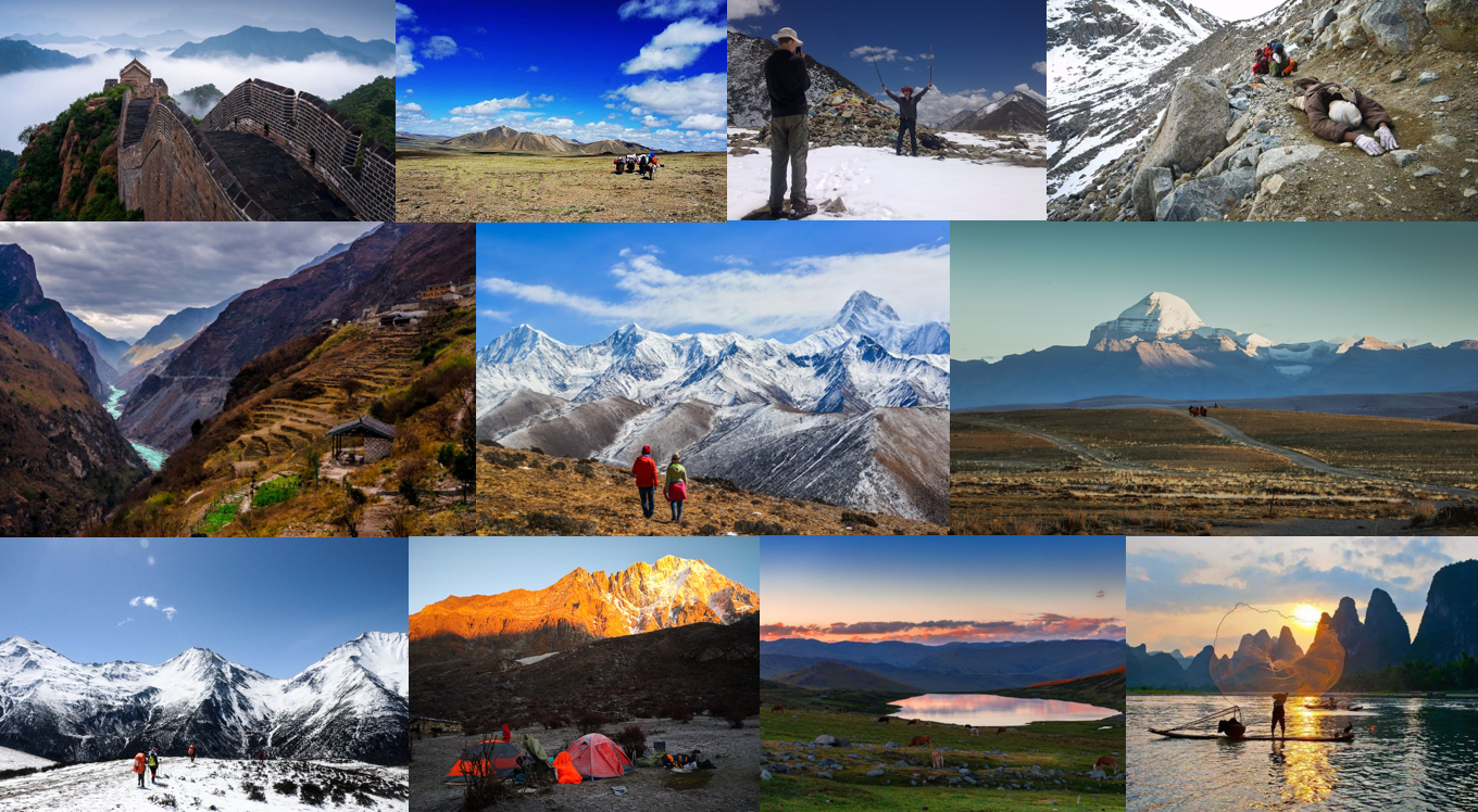
Top 10 Hiking Routes in China
As a country with a vast territory, China has a large scale of diverse breathtaking landscapes, from towering mountains to flat plains, fast-flowing rivers to tranquil lakes, dense forests to vast grasslands, vivid countryside to barren Gobi and deserts… In addition to the stunning natural landscape, as a multicultural country with a history of over 5,000 years, there are countless distinct cultural and historical wonders scattered across its every corner.
As a place with amazing landscapes and colorful multi-ethnic cultures, no matter if you are trekking enthusiasts or experienced mountaineers and whatever you are seeking, a challenging adventure, a visual feast, a spiritual journey, different lifestyles, or diverse culture exploration, China has the most stunning and unique hiking routes are worth the effort, from easy day hikes at the beautiful countryside to several days strenuous hiking routes in Tibet with an average altitude of over 4,000 meters to suit hikers of all levels and match all your desires. Here we have carefully handpicked the top 10 most popular and classic hiking routes in China for travelers to choose from.
.png)
Beijing | The Great Wall – Feel the important historical significance
The Great Wall, one of the most stunning man-made landscapes in the world, is the only artificial structure on earth that can be seen from the moon with a history of over 2000 years. Declared a World Cultural Heritage Site in 1987, it is one of the best highlights for international travelers to tour China and admire its stunning landscape. To explore China’s Great Wall and admire its spectacular views, there is no better way than hiking or walking along with it.
However, as a vast awe-inspiring feat of the ancient military project stretching from east to west for thousands of miles, even for the most ambitious trekkers, it is undoubtedly a huge challenge to complete the whole journey of the Great Wall, hence, many people is likely to choose a section of the Great Wall as your target when walking on the Great Wall. The sections of Great Walls near Beijing become the best choice for trekkers to explore and challenge themselves. The Great Wall hiking can often be as short as one day or even as long as 3-5 days, which definitely depends on your interests and vacation. See below the 2 best day hikes to get some inspiration for your Great Wall trekking.
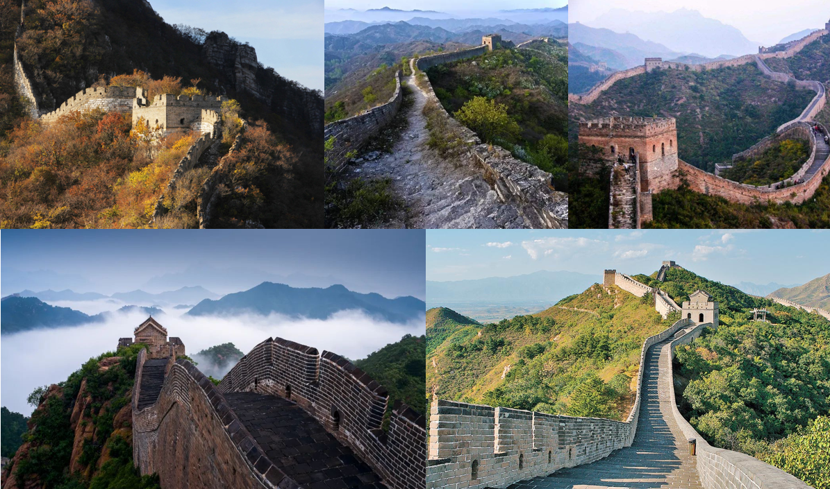
Jinshanling to Simatai
You’ll trek through the most beautiful section among the Great Wall which winds through steep mountains and ridges covered by dense forests. Here you can not only challenge yourself but also appreciate the fabulous scenery as well as some ruined sections, the trekking also provides hikers with a more authentic “wall” experience.
- Distance: 12 kilometers
- Duration: about 4-5 hours trekking
- Scenery: ⭐⭐⭐⭐
- Difficulty: ⭐⭐ suitable for beginners
- Distance from Beijing: 130KM away from Beijing, about 2.5 hours drive.
- Best time to trek: Spring and Autumn (April, May, September, and October).
Jiankou to Mutianyu (Wild Hike)
As one of the best hikes and one of the most dangerous wild Great Wall sections built on the steep mountain ridges with dangerous cliffs, the Jiankou to Mutianyu hike is a challenging route but brings unique rewards, as it is the most authentic section of the Great Wall closest to nature. Besides, the scenery along the route is breathtaking without crowds.
- Distance: 10 kilometers
- Duration: about 5 hours trekking
- Scenery: ⭐⭐⭐⭐
- Difficulty: ⭐⭐⭐
- Distance from Beijing: 100KM away from Beijing, about 2 hours drive.
- Best time to trek: Spring and Autumn (April, May, September, and October).
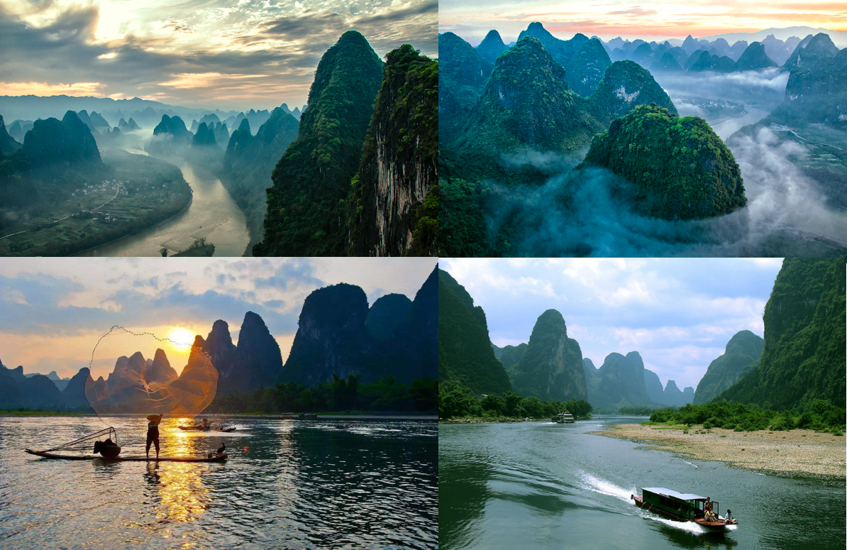
Guilinu4e28Li River and Yangshuo Countryside – Appreciate most beautiful scenery
Boasting fantastic natural Karst landscapes and dynamic ethnic cultures, Guilin has become one of the most popular travel destinations among global travelers. The Li River, originating from Maoer Mountain in Xing’an County, northeast of Guilin, and flowing through Guilin and Yangshuo to Pingle County, with a total length of 437 kilometers, is indisputably the essence of Guilin’s scenery with green mountain peaks, blue loating waters, and beautiful scenery, owning the reputation of “hundred miles Li River, hundred miles gallery”.
However, the most quintessential part of the Li River landscape lies on the Li River hiking route, a more than 10 kilometers hiking route starting from the Yangdi Wharf in Yangshuo and ending at Xingping old town. It usually takes half-day to 1 day to complete, giving the opportunity for tourists to appreciate the fascinating scenery of the Li River closely and comprehensively like ink paintings. The entire route has no difficulty coefficients and hidden safety hazards and becomes the favorite leisure travel method for domestic and international tourists.
- Distance: 14.7 kilometers
- Duration: half-day to 1 day
- Starting point: Yangdi
- Ending point: Xingping
- Scenery: ⭐⭐⭐⭐⭐
- Difficulty: ⭐
- Best time to trek: Every April to October
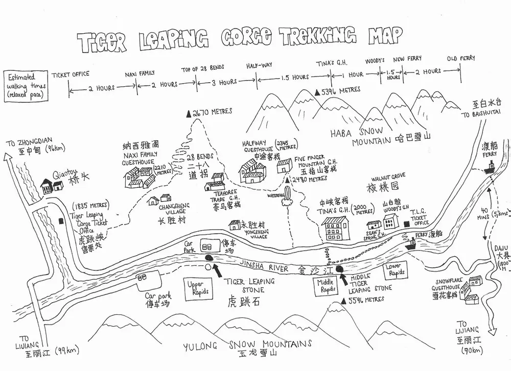
Yunnan丨Tiger Leaping Gorge – A fashionable crossing
Tiger Leaping Gorge trekking is renowned as one of the most popular trekking routes in the world with fabulous scenery ideal for the beginners to trek, attracting countless domestic and foreign trekking enthusiasts every year. Located about 96 kilometers away from Shangri-La and 90 kilometers away from Lijiang, it can be reached by road from Lijiang or Shangri-la, while most travelers will choose to enter from Lijiang, then continue their trip to Shangri-la after the trekking. Tiger Leaping Gorge is one of the deepest canyons in the world, famous for its dangers, swift water, thrilling cliff plank, majestic and steep valleys with a vertical height difference of 3790 meters, which is also a must-see site in Yunnan tour. It can be divided into 3 sections with a series of 18 rapids: the Upper Tiger Leaping Gorge, the Middle Tiger Leaping Gorge, the Lower Tiger Leaping Gorge. The scenery of the upper and middle Tiger Leaping Gorge is the most beautiful, especially the middle Tiger Leaping Gorge.
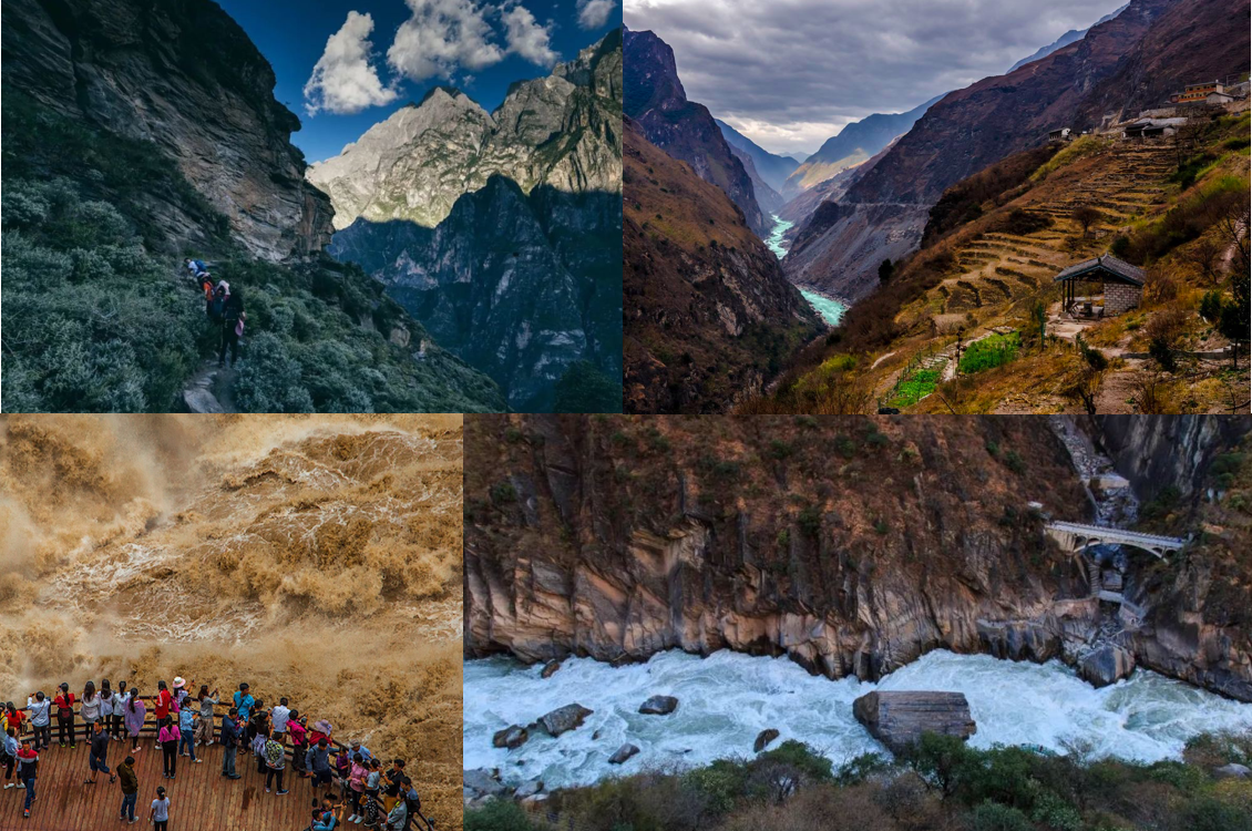
Usually, the trek route includes 2 parts, the high road trekking and the middle Tiger Leaping Gorge trekking, requiring 1.5 days to complete, while for those who want to complete the whole journey, they also can continue from the Middle Tiger Leaping Gorge to the lower Tiger Leaping Gorge which takes at least 2 days, and then go to Lijiang via Dagu. It is a relatively mature route with complete accommodation facilities and physical and technical requirements not high.
- Duration: 1.5 days
- Starting point: Qiaotou
- Ending point: Middle Tiger Leaping Gorge
- Scenery: ⭐⭐⭐⭐
- Difficulty: ⭐⭐
- Accommodation: Local Guesthouse
- Best time to trek: April to early June, and mid-September to October
- Brief daily trekking itinerary:
- Day 01: Qiaotou – Naxi Family Guesthouse – 28 Bends – Tea Horse Guesthouse, 5 hours’ trek;
- Day 02: Tea Horse Guesthouse – Half-way Guesthouse – Tina’s Guesthouse – Middle Tiger Leaping Gorge, 6-7 hours’ trek.
Sichuan┃Mount Siguniang Changping to Bipenggou trek – the Alps in China
Mount Siguniang, known as the eastward Alps due to its singular peaks and unique landscape resembling the real Alps, is the most famous among outdoor enthusiasts for its four snow-capped peaks, named Yaomeifeng, Sanfeng, Erfeng, and Dafeng at the elevation of 6,250m, 5,664m, 5,454m, and 5,055m respectively, as well as the 3 beautiful valleys surrounded by continuous mountain peaks and beautiful glaciers. People usually choose to start their Mount Siguniang exploration from Chengdu, which only requires 4 hours’ drive/220km.
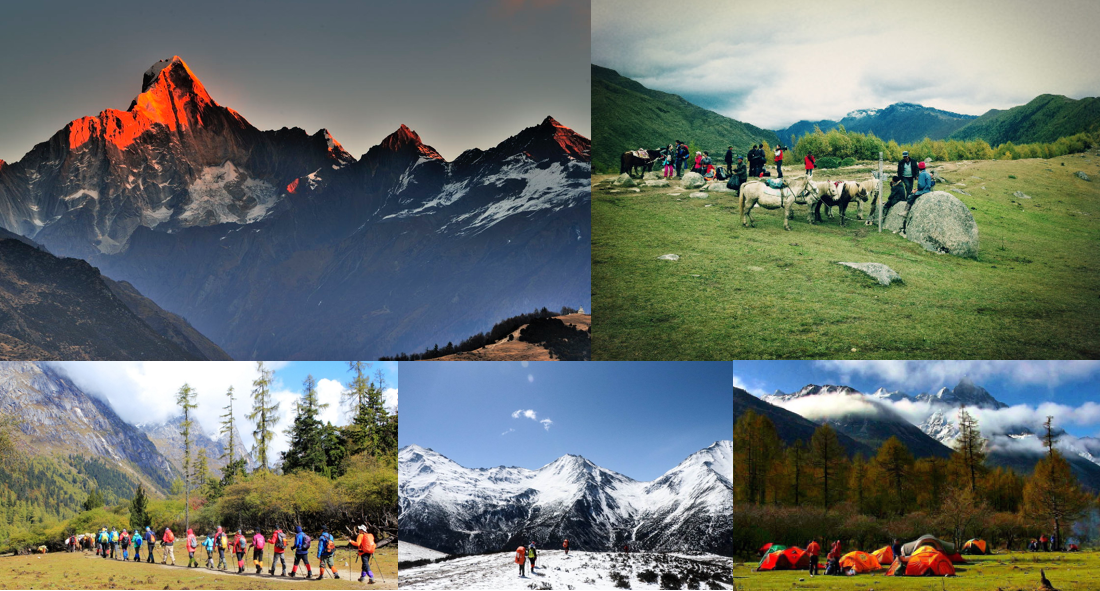
Abundant with natural and mountain resources, Mount Siguniang is regarded as the paradise for outdoor activities such as trekking, mountain climbing, rock climbing, etc. As one of the untouched and unspoiled corners of China with charming scenery and fascinating trekking trails, every year, there are thousands of travelers and trekkers walking along the off-the-beaten paths to admire its unique landscape, experience the distinct lifestyle of local Tibetans, and conquer the singular peaks. There are lots of stunning trekking trails, from easy day hikes to multi-day wild explorations, among them, the most popular and classic route is the 3 days hike from Changping Valley to Bipeng Valley. Have a quick look at the info below to get some inspiration.
- Duration: 3 days
- Starting point: Changping Valley
- Ending point: Bipeng Valley
- Highest point: Mountain pass between the 2 valleys (4,750 m)
- Scenery: ⭐⭐⭐⭐⭐
- Difficulty: ⭐⭐⭐
- Accommodation: Camping
- Tibet permit: No need
- Best time to trek: Late-September to November
- Brief daily trekking itinerary:
- Day 01: Siguniangshan Town – sightseeing bus to Lama Temple – Dead Tree Beach – Muluozi campsite, trek about 5-6 hours/15km, 500 meters ascend;
- Day 02: Muluozi – Shuidaba – Wuguishi – Chazigouwei campsite, trek about 6-7 hours/14km, 300 meters ascend;
- Day 03: Chazigouwei – Mountain pass (4,750 m) – Three Trees Campsite – Panyang Lake – Moon Bay Reception Station – sightseeing bus to Upper Lake and further to Bipeng Valley exit, trek about 10 hours/23.5km, 1,050 meters ascend and 1,100 meters descent.
Sichuan┃Hiking Yading Nature Reserve in Daocheng – the last Shangri-la
Yading Nature Reserve, 108km away from Daocheng, is a harmonious utopian land located in the Western Sichuan Plateau with breathtaking scenery, and a must-see when making a western Sichuan tour. Reputed as ‘the last pure land on our blue planet’ and ‘the last Shangri-la’, it has all the elements of a snow-covered plateau: snow-capped mountains; beautiful glaciers, crystal clear lakes, trickling streams, vast alpine meadows, as well as the dense forests. People usually take a land tour from Chengdu or Shangri-La to here. Some of them may choose to take a flight to Daocheng from Chengdu first, then drive about 2 hours to Yading Nature Reserve.
Regarded as a sacred place by hikers, it has mature and challenging hiking routes, including the small Kora covering the essence of Yading, the big Kora that walks clockwise around three snow-capped mountains, and even longer distance Yading-Muli, Yading-Lugu Lake crossing. No matter if you are beginners or professional hikers, you can enjoy the wonderful experience of “the body is in hell, but the eyes are in heaven” here. Considering the safety issue, we have handpicked 3 popular routes below for your reference.
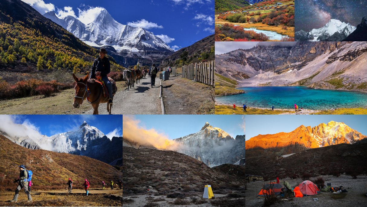
1. Small Kora trekking (the most popular)
The difficulty of this route is moderate. Although it is the most basic tour route, it is not easy to walk on the plateau with an average altitude of 4000 meters or more. This itinerary almost condenses the core landscape of Yading, suitable for beginner hikers and photographers.
- Duration: 2 days
- Starting point: Yading village (3,900 m)
- Ending point: Yading village
- Highest point: Five Color Lake (4,700 m)
- Scenery: ⭐⭐⭐⭐⭐
- Difficulty: ⭐⭐⭐
- Accommodation: Local guesthouse or hotels
- Tibet permit: No need
- Best time to trek: April, May, September, and October
- Brief daily trekking itinerary:
- Day 01: Yading village – Longlongba – Chonggu Temple (3,880 m) – Pearl Lake (4,100 m) – Yading Village (3,900 m);
- Day 02: Yading Village – Longlongba – Chonggu Temple – Luorong Pasture (4,150 m) – Milk Lake (4,600 m) – Five Color Lake (4,700m) – Yading Village – sightseeing bus to Shangri-la Town.
2. Yading Niru Crossing Trek (Wild Exploration)
It is one of the classic routes recognized by trekkers, and called “the crossing between hell and heaven”. The crossing along this route offers you an amazing visual feast with primitive and stunning scenery including pastures, waterfalls, lakes, strange rocks, snow-capped mountains, glaciers, rivers, dense forests, and distinct villages. And the road is relatively safe, but the altitude difference is large, making it require excellent physical strength and endurance, especially to overcome the high altitude sickness. The whole journey traverses 120 kilometers and lasts 5 days. The lowest point is 2,100 meters and the highest point is about 4,800 meters.
- Duration: 5 days
- Starting point: Niru Village (2,705 m)
- Ending point: Yading Village (3,900 m)
- Highest point: Songduo Pass (4,730 m)
- Scenery: ⭐⭐⭐⭐⭐
- Difficulty: ⭐⭐⭐⭐
- Accommodation: Camping + local guesthouse
- Tibet Permit: No need
- Best time to trek: April, May, September and October
- Brief daily trekking itinerary:
- Day 01: Niru Village (2,705 m) – Mountain pass (4,100 m) – Selie Lake (3,949 m) – Nanbao Pasture (4,013 m) – camp at Xinzhaihe Pasture (3,700 m), 24km’s trekking;
- Day 02: Xinzhaihe Pasture (3,700 m) – Sela Pass (4,300 m) – Rida Pass (4,500 m) – camp at Yala Pasture (4,200 m). 20km’s trekking;
- Day 03: Yala Pasture (4,200 m) – Yala Holy Mountain – Nigong Village (2,100 m) – Dongyi District by car to Kas Village (2,822 m), overnight at the local guesthouse, 19km’s trekking;
- Day 04: Kasi Village (2,822 m) – Kas Hell Valley – Kas Cowshed – Camp at the foot of Xiannairi Mountain (4480 meters), 12km’s trekking;
- Day 05: Camp at the foot of Xiannairi Mountain (4480 meters) – Regsum-tso Lake – Songduo Pass (4,730 m) – Snake Lake – Milk Lake – Five Color Lake – Luorong Pasture – Chonggu Temple – Pearl Lake – Yading village, 20km’s trekking.
3. Muli-Yading Crossing Trek (Wild Exploration)
With a harsh environment, simple camping conditions, and long hikes, a crossing trek through this route is not easy. After several years of accumulation and development, the safety of this route has become very high. By bringing unexpected rewards with impeccable scenery, moderate difficulty, guaranteed safety, and cost-effectiveness, it becomes an unconventional trekking route in Yading and popular among trekkers.
- Duration: 6 days
- Starting point: Muli County
- Ending point: Yading Village
- Scenery: ⭐⭐⭐⭐⭐
- Difficulty: ⭐⭐⭐⭐
- Accommodation: Camping
- Tibet Permit: No need
- Best time to trek: April, May, September and October
- Brief daily trekking itinerary:
- Day 01: Muli County – Dulu Village, Shuiluo Township, Muli, camp at the altitude of about 2,700 m;
- Day 02: Dulu Village – Guoshuiluo Gold Mine – Bodhisattva Cave, 6 hours trekking, camp at an altitude of 3,600 m;
- Day 03: Bodhisattva Cave – Mancuo Cattle Farm – trek around Xialuo Duoji Mountain – Zangbie Cattle Farm (Xiari Cattle Farm) – Camp under the Zabala Pass, 8 hours trek, camp at an altitude of 4,600 m;
- Day 04: Zangbie Cattle Farm – Zabala Pass – Xinguo Cattle Farm, 8 hours trek, camp at an altitude of 4,200 m;
- Day 05: Xinguo Cattle Farm – Black Sea – Xiadu Cattle Farm – Snake Lake, 7 hours trek, camp at an altitude of 4,400 m;
- Day 06: Snake Lake – Mountain Pass – Milk Lake – Five Color Lake – Luorong pasture – Yading village (3,900 m).
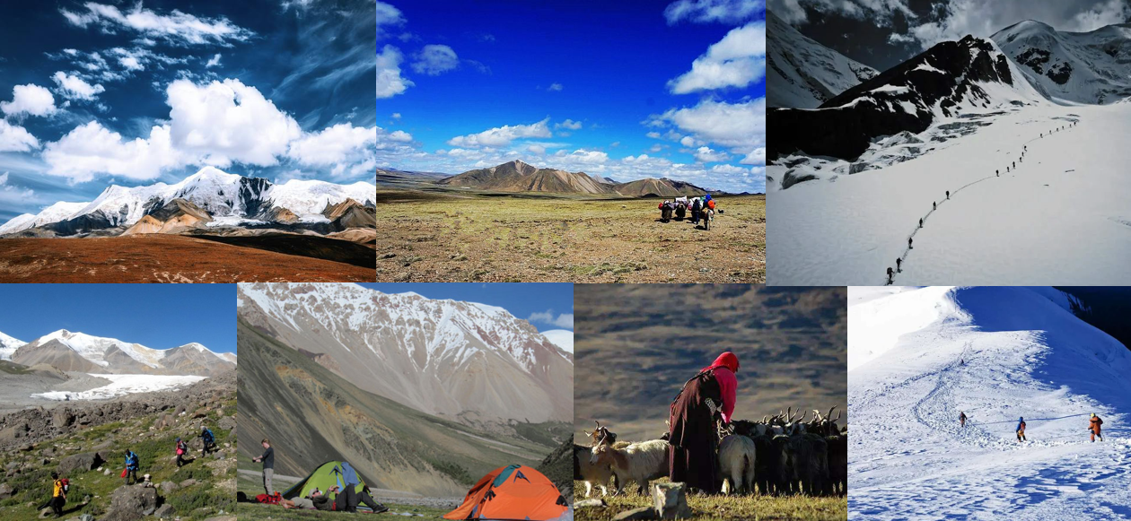
Sichuan┃Minya Konka Great Loop – Intimate contact with the “king of Shushan”
Minya Konka, or Mount Gongga, situated at an elevation of 7,556 meters, is the highest mountain in Sichuan province, hence, its reputation as “The King of Sichuan Mountains”. The most amazing thing about Gongga Mountain is its huge height difference, which is over 6000 meters making it be the mountain in the world with the highest height difference. Surrounded by more than a hundred peaks with an altitude of 5,000-6,000 meters, it is one of the most difficult mountains in the world to climb, showing the charm of the king.
Since it was introduced to the outside world by Joseph F. Rock in 1930, climbers have never stopped trying to climb it, however, the main peak of it has maintained a high mortality rate far exceeding the 14 over 8000-meter peaks. With an awe-inspiring height and prohibitive difficulty, turning around the mountain has become a way to worship the sacred mountain of Gongga. Usually, climbers will use Chengdu or Kangding as the gateway for their Mount Gongga adventures, from there, they can take a public bus or hire a car through a local China travel agency to the start point of the Gongga Great Loop crossing to start the trekking.
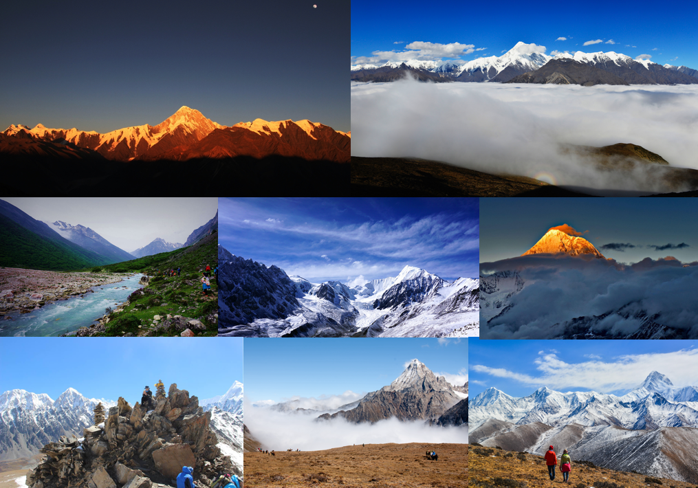
The most classic route from Gongga to the mountain is called the “Perfect Crossing of the Gongga Great Loop”, which offers a panoramic view of the Gongga hinterland and the Gongga mountains from all angles. During the trek, you can enjoy the marvelous scenery of snow-capped peaks, glaciers, ice lakes, and shoot the spectacular sunrise and sunset at Gongga Mountain. Below is a general introduction of the route for reference.
- Duration: 6 days
- Starting point: Power Station near Laoyulin
- Ending point: Jiebei Stone
- Highest point: Riwoche Pass (4,900m)
- Scenery: ⭐⭐⭐⭐⭐
- Difficulty: ⭐⭐⭐⭐⭐
- Accommodation: Camping
- Tibet Permit: No need
- Best time to trek: April to October
- Brief daily trekking itinerary:
- Day 01: Drive 1 hour to Laoyulin from Kangding – Power Station to start the trek – Liangchahe (3,900m), trek about 5-6 hours/11km;
- Day 02: Liangchahe (3,900m) – Lower Riwoche – Upper Riwoche (4,200m), trek about 5 hours/9km;
- Day 03: Upper Riwoche (4,200m) – Riwoche Pass (4,900m) – Upper Moxi Valley (3,900m), trek about 8 hours’ trek/18km;
- Day 04: Upper Moxi Valley (3,900m) – Winter Pasture (3,600m) – Gongga Monastery (3,900m), trek about 8-9 hours/25km;
- Day 05: Gongga Monastery (3,900m) – Lower Zimei Village, then take a van to Zimei Pass and back (1hr’s drive); trek about 2 hours/8km;
- Day 06: Lower Zimei Village – Bawang Lake – Jiebei Stone – Caoke, trek about 6 hours/18km.
Qinghai | Amnye Machen Snow Mountain trek – Walking on the pilgrimage
Amnye Machen Snow Mountain, known as Maji Snow Mountain or Machen Snow Mountain, is located in the northwest of Machen County, Golog Tibetan Autonomous Prefecture, Qinghai Province, traditionally, it belongs to the Amdo Tibetan Area. As the largest mountain at the source of the Yellow River, it stretches about 28 kilometers long and 10 kilometers wide. The Yellow River made a 180-degree turn in the Amnye Machen Mountain and then flowed southeast. The main peak, Maqen Gangri, at the altitude of 6,282 meters, is in the center of the turn.
This majestic mountain consists of 13 peaks and 57 glaciers. Among them, the Halong Glacier on the northeast slope is the largest and longest glacier in the Yellow River Basin with a length of 7.7 kilometers and a vertical elevation difference of 1,800 meters. The bizarre glacial world here is with various poses and dazzling colors. The abundant ice and snow melted water gathers into countless trickle streams, winding and staggering, and diverse lakes in different sizes are shining brightly.
Regarded as one of the 4 most sacred mountains by Tibetans, it is said that the highest peak of this mountain is the place where the protector deity Machen Pomra resides. The pilgrimage circuit around the mountain is popular among Buddhists as well as adventurous trekkers. Generally, it takes 7-8 days to walk around the mountain, with an average trek distance of about 15-16KM with 6-7 hours per day, 5 days to ride a horse, and more than 60 days to kowtow (five body throws). It is a great experience to follow the steps of the pilgrims to trek, during which you will encounter many strange natural phenomena, such as strange landforms, rugged rocks, unpredictable weather, the sound of clear streams, waterfalls where the Milky Way falls, and various wild animals, etc. , All these seem to be a gift from God, making it be a dreamlike world to conquer.
- Distance: 168KM
- Duration: 6-9 days
- Starting point: Machen
- Ending point: Machen
- Highest point: Drakdar Pass (4,700m)
- Scenery: ⭐⭐⭐⭐⭐
- Difficulty: ⭐⭐⭐⭐
- Accommodation: Camping
- Tibet Permit: No need
- Best time to trek: Late April to October
- Brief daily trekking itinerary:
- Day 01: Drive from Machen to Tsanak Kamdu – Langri, 15KM, about 6 hours’ trek;
- Day 02: Langri – Tamchok Gongkha La Pass (4,600 m) – Tamchok Gongkhar, 24KM, about 8 hours’ trek;
- Day 03: Tamchok Gongkhar – the Rock Valley of Mowatowa (Shima Tongpul), 20KM, about 7 hours’ trek;
- Day 04: The Rock Valley of Mowatowa (Shima Tongpul) – Deleni, 22KM, about 8 hours’ trek;
- Day 05: Deleni – Jomoyangra (4,200 m), 14KM, about 6 hours’ trek;
- Day 06: Jomoyangra – Dodrub Chode – Jiashinongke (4,300 m), 15KM, about 6 hours trek;
- Day 07: Jiashinongke – Chablong, 18KM, about 6 hours’ trek;
- Day 08: Chablong – Drakdar Pass (4,700m) – Halong-Chu Valley, 22KM, about 6 hours’ trek;
- Day 09: Halong-Chu Valley – Chorten Karpo (White Pogoda) at Chumarna, 18KM, about 6 hours’ trek – drive to Machen.
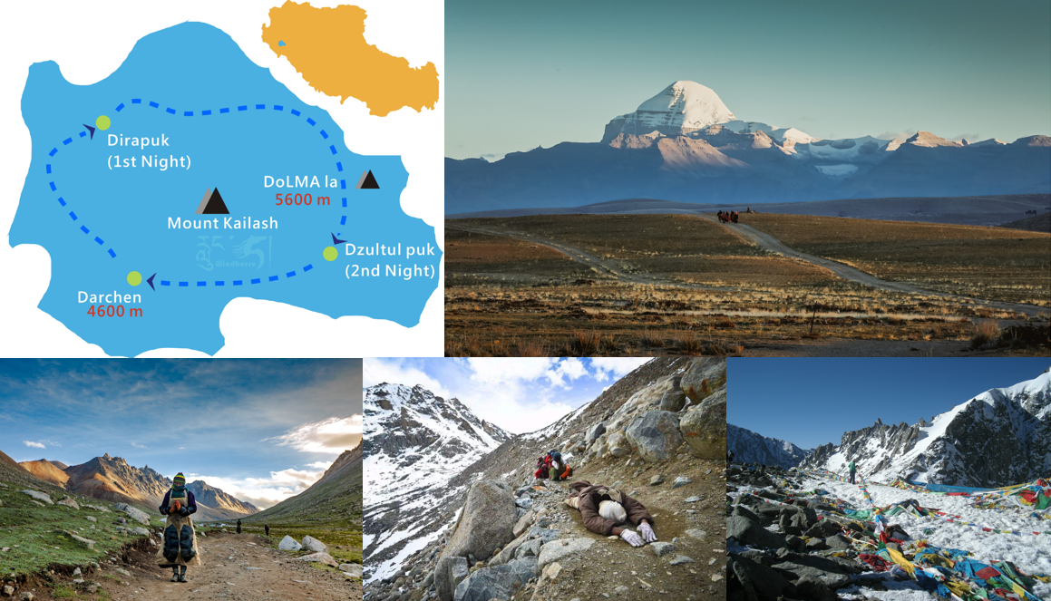
Tibet 丨Mt. Kailash Kora Trek – Walking on the pilgrimage
Asia’s holiest mountain, Mt. Kailash, at an altitude of 6,638 meters above sea level, is the main peak of Gangdese Mountain Ranges. Mt means “the dwelling place of the gods” in Tibetan, worshiped by Hinduism, Tibetan Buddhism, Bon religion and ancient Jainism. As of its challenging adventures and spiritual significance, it attracts thousands of travelers all over the world and hundreds of pilgrims to trek along its age-old sacred Kora, one of the world’s great pilgrimage routes with a 5,630m pass to conquer, every late April to October, particularly few days around the Saga Dawa Festival (every April 15 of Tibetan calendar/late May or June of the Gregorian calendar).
The local Tibetans usually spend one day to complete the 52KM’s fascinating Kora, but for trekkers, it is recommended to finish in 3 days to have a comfortable trek. The trek’s start point Darchen is about 200KM’s away east of Zanda and 1,300KM away west of Lhasa, people usually start their holy trip directly from Lhasa or Kathmandu by a 3-day single-way drive to Darchen. Thanks to the use of Nagri Gunsa Airport, it is possible for tourists to reach Mt. Kailash with a combination of flights and driving by car to save time and avoid long driving time every day. Follow the info below to get some idea about Mt. Kailash pilgrimage circuit.
- Distance: 52KM
- Duration: 3 days
- Starting point: Darchen (4,675m)
- Ending point: Darchen
- Highest point: Drolma-la Pass (5,630m)
- Scenery: ⭐⭐⭐⭐⭐
- Difficulty: ⭐⭐⭐⭐⭐
- Accommodation: camping or local monastery guesthouse
- Tibet Permit: Tibet Tourist Bureau Permit, Aliens’ Travel Permit, Military Permit
- Best season to trek: mid-May to mid-October
- Brief daily trekking itinerary:
- Day 01: Darchen (4,675m) – Prayer square/two-legged’ Chörten Kangnyi (4,790m) – Chuku Monastery (4,820m) – Dira-puk Monastery (5,080m), trek about 6 hours/20km;
- Day 02: Dira-puk Monastery – Shiva-tsal (5,330m) – Drölma-la (5,630m) – Zutul-puk Monastery (4,820m), trek about 7-8 hours/18km;
- Day 03: Zutul-puk Monastery – Barkha Plain – Darchen, trek about 3-4 hours/14km.
Tibet丨Ganden to Samye Trek – Measure the pilgrimage route on foot
It is the most classic connection between the two golden-topped monasteries: Ganden – the ancestral temple of the Gelug Sect and Samye – the first monastery in Tibet. For hundreds of years, Lamas in robes and pilgrims have walked in the undulating valleys under the strong sunlight of the Tibetan Plateau just to achieve their beliefs. Starting from Ganden Wangbur Mountain by Lhasa River, they crosse the mountain and river valley, walkthrough plateau wetlands, visit villages and pastures, explore the primitive Yarlung Zangbo River, and finally arrive at Shannan Samye Monastery, the birthplace of Tibetan civilization. As a result, this previously unknown pilgrimage road became the top Tibet trekking route in Lhasa due to its changeable mountain scenery and beautiful mountain lakes.
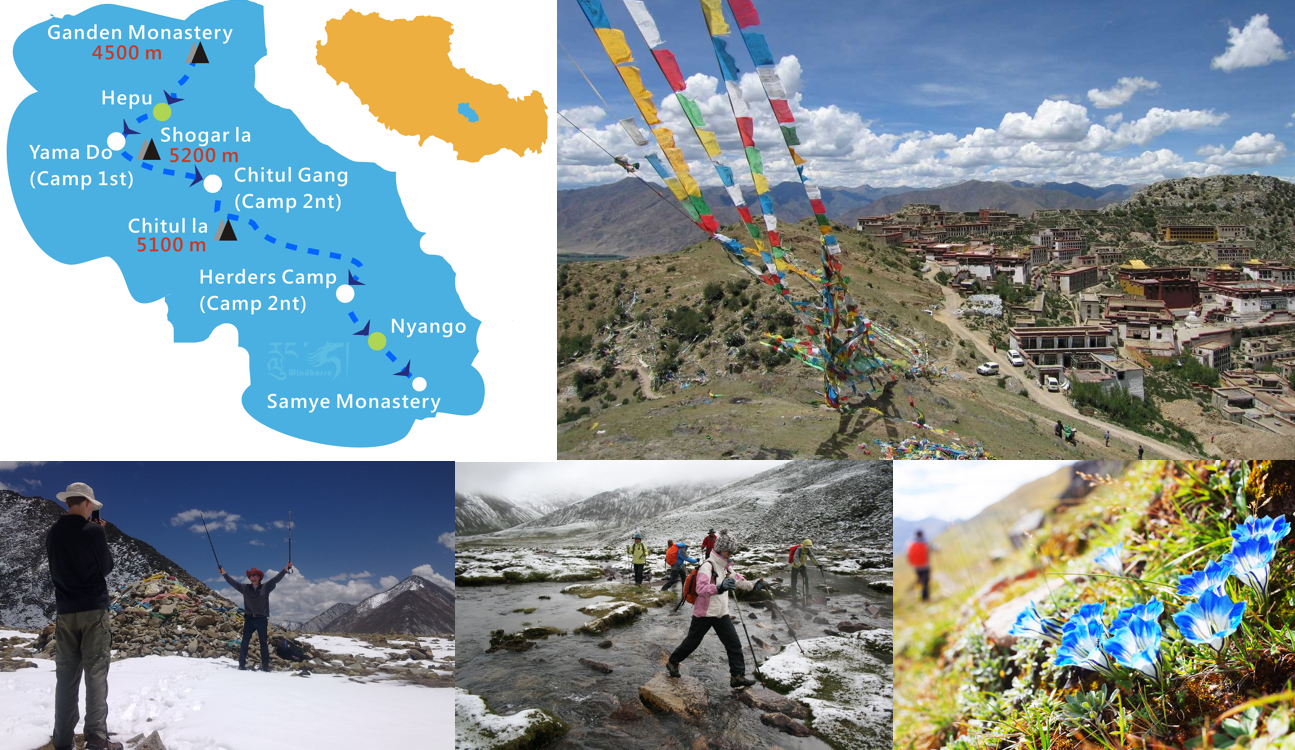
This is a relatively arduous trekking route with a total length of 80KM, usually, it takes about 4-5 days to complete it. In addition, it is a really high altitude hiking route, en route, you need to cross two mountain passes, Shukala Pass at 5,284 meters and Chitula Pass at 5,245 meters, as well as the valley between the two mountain passes at 4,940 meters. Snow will come unexpectedly at any time of the year. Follow the info below to get some general ideas of this trekking route.
- Distance: 80KM
- Duration: 4-5 days
- Starting point: Ganden Monastery (4,190m)
- Ending point: Samye Monastery (3,630m)
- Highest point: Shuga-la Pass (5,284m)
- Scenery: ⭐⭐⭐⭐⭐
- Difficulty: ⭐⭐⭐⭐
- Accommodation: camping
- Best time to trek: mid-May to early-October
- Tibet Permit: Tibet Tourist Bureau Permit, Aliens’ Travel Permit
- Brief daily trekking itinerary:
- Day 01: Ganden Monastery (4,190m) – Hepu (4,240m) – Yama Do (4,490m), trek about 5-6 hours/17km;
- Day 02: Yama Do – Shuga-la Pass (5,250m) – Tsotup-chu Valley (4,980m), trek about 5-7 hours/10km;
- Day 03: Tsotup-chu Valley – Chitu-la Pass (5,210m) – Herders’ Camp, 14KM/ trek about 5 hours/14km;
- Day 04&05: Herders’ Camp – Yarmalung Heritage – Samye Monastery (3,630m), trek about 10 hours/39km.
Xinjiang丨Kanas – Indulge in beautiful scenery of Northern Xinjiang
Kanas, which means “beautiful, rich and mysterious place” in Mongolian, is nestled in the deep forests and mountains of the north of Burqin County, Altay Region, Xinjiang, the edge of the northwestern corner of China. It is a rare cold-temperate plant gene bank in the world today, the birthplace of the Burqin River, the largest tributary of the Irtysh River, and the last settlement of the Mongolian Tuva people in China. Reputed as “Oriental Switzerland, a photographer’s paradise”, here, the lost primitive nomadic life is intertwined with grasslands, birch forests, snow-capped mountains, and lakes, weaving primitive and wild dreams.
The trek across Kanas Scenic Area often brings trekkers with unique rewards, not only excellent experience but also a visual feast. The magnificent glaciers set off the tranquil lake water, and the vast grasslands contain deep virgin forests, horses and cherishing animals graze and run casually, the distinct folk houses scatter through the quiet and peaceful ancient villages, primitive Tuva people work among the dazzling scenery, everything here is in harmony, making the trekking along this route such fantastic.
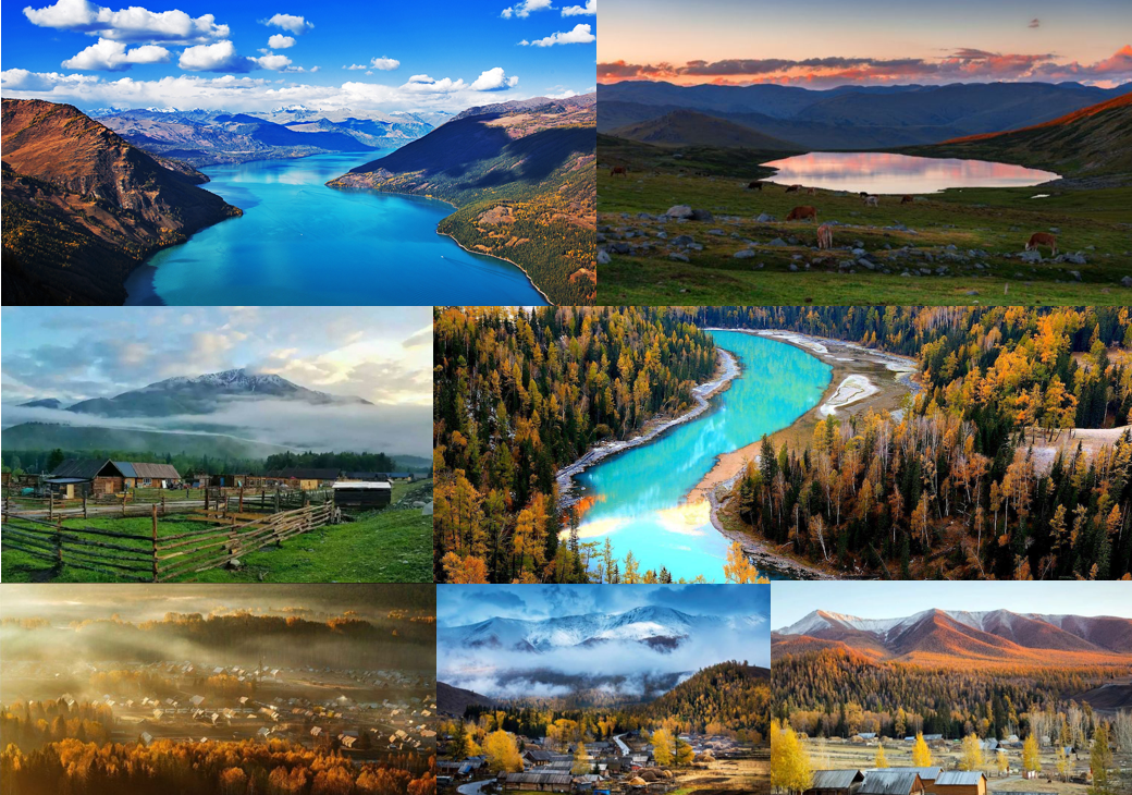
As one of China’s top ten classic hiking routes, it offers the ultimate autumn scenery and local ethnic customs experience. You can experience Kazakh and Mongolian Tuva homestay, visit the picturesque Hemu Village (photographer’s dreamland and god’s private place), enjoy the beautiful Black Lake (the best starry sky shooting location in the original mountain Haizi), see the stunning Kanas (top-level Swiss scenery with 3 bays and Kanas Lake), appreciate the tranquil Twin Lake (a secret lake hidden in the core reserve of Kanas), and visit Baihaba village (the first village in Northwest China and the location of the Sino-Kazakh border).
- Duration: 5-6 days
- Starting point: Jiadengyu (1,600m)
- Ending point: Baihaba
- Scenery: ⭐⭐⭐⭐⭐
- Difficulty: ⭐⭐
- Accommodation: camping or local guesthouse or hotel
- Best season to trek: June to October, especially late-August to early October
- Brief daily trekking itinerary:
- 1. The most popular route
- Day 01: Jiadengyu – Half-way Guesthouse or Delta Campsite, trek about 5-6 hours/20km;
- Day 02: Half-way Guesthouse or Delta Campsite – Hemu village, trek about 5 hours/15km;
- Day 03: Hemu village – Black Lake campsite, trek about 8 hours/20km;
- Day 04: Black Lake campsite – Kanas Lake, trek about 7 hours/20km;
- Day 05: Kanas Lake – Baihaba village, trek about 4-5 hours/20km, or you can choose to drive to Baihaba village.
- 2. The more virgin scenery route
- Day 01: Jiadengyu – Half-way Guesthouse or Delta Campsite, trek about 5-6 hours/20km;
- Day 02: Half-way Guesthouse or Delta Campsite – Hemu village, trek about 5 hours/15km;
- Day 03: Hemu village – Black Lake campsite, trek about 8 hours/20km;
- Day 04: Black Lake campsite – Kanas Lake, trek about 7 hours/20km;
- Day 05: Kanas Lake – boat to Teiwaike – Twin Lake – Naren Passture, trek about 5-6 hours/16km;
- Day 06: Naren Passture – Dongguo Lieke – Baihaba village, trek about 8 hours/25km.
Hiking/trekking by foot is always the best way to appreciate the beautiful scenery of nature and challenge yourself. China is a place with astonishing natural wonders scattering its every corner, go through our well-designed China trekking tour or Tibet trekking tour to pick one route to follow or contact us directly to plan your unique trekking tour to China.
Related tours

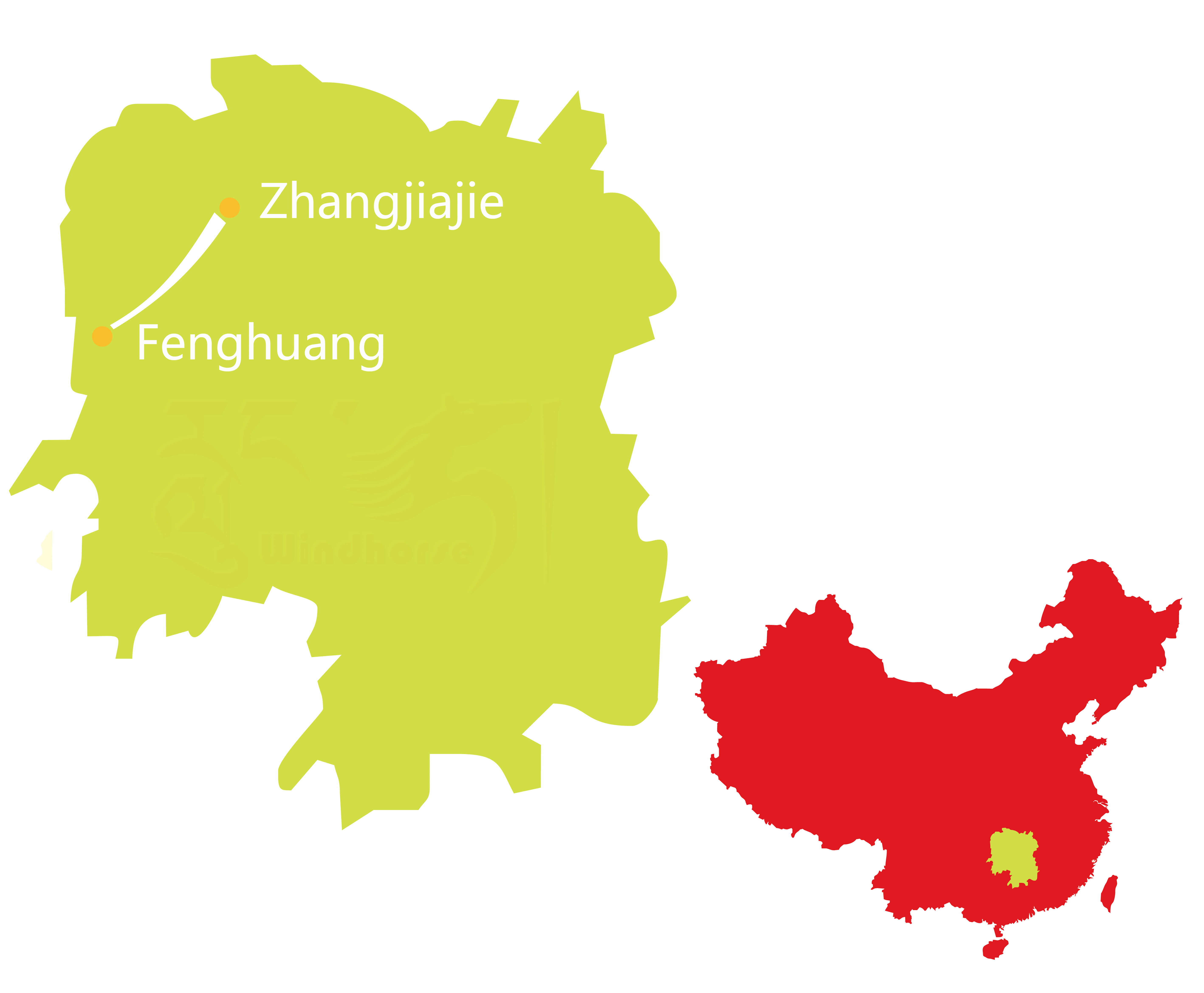


Experience the best of Hunan on this 6-day Zhangjiajie & Fenghuang Tour. Explore the stunning peaks of Zhangjiajie National Park, walk the world-famous Glass Bridge, ascend Tianmen Mountain, and uncover the charm of Fenghuang Ancient Town with its riverside stilt houses and vibrant night views.

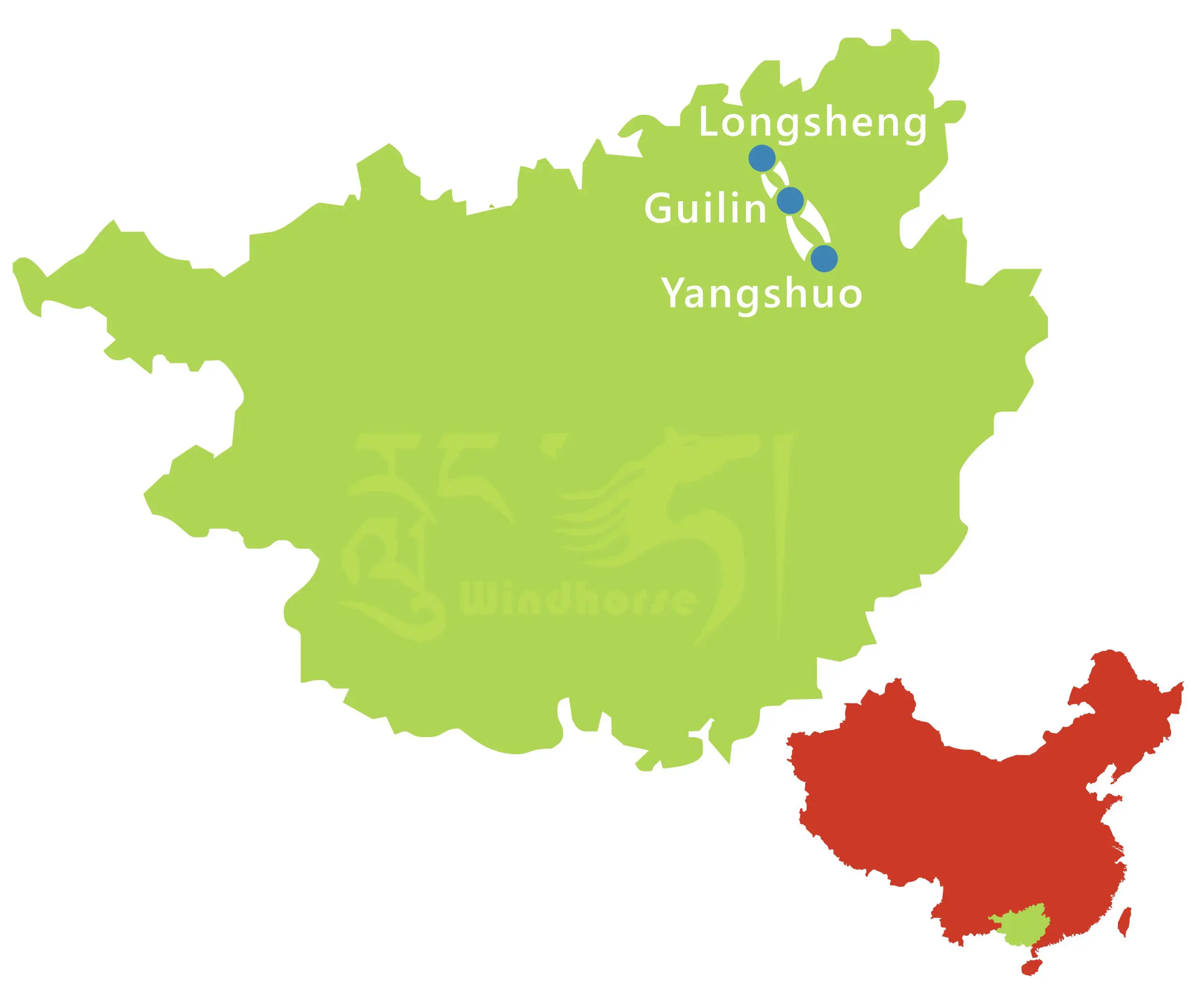


Discover the beauty of Guilin with your own eyes, and view the breathtaking scenery. Relax while cruising along the picturesque Li River. Then explore deep into the classical teared Chinese countryside on a bicycle. Amazing memories await.

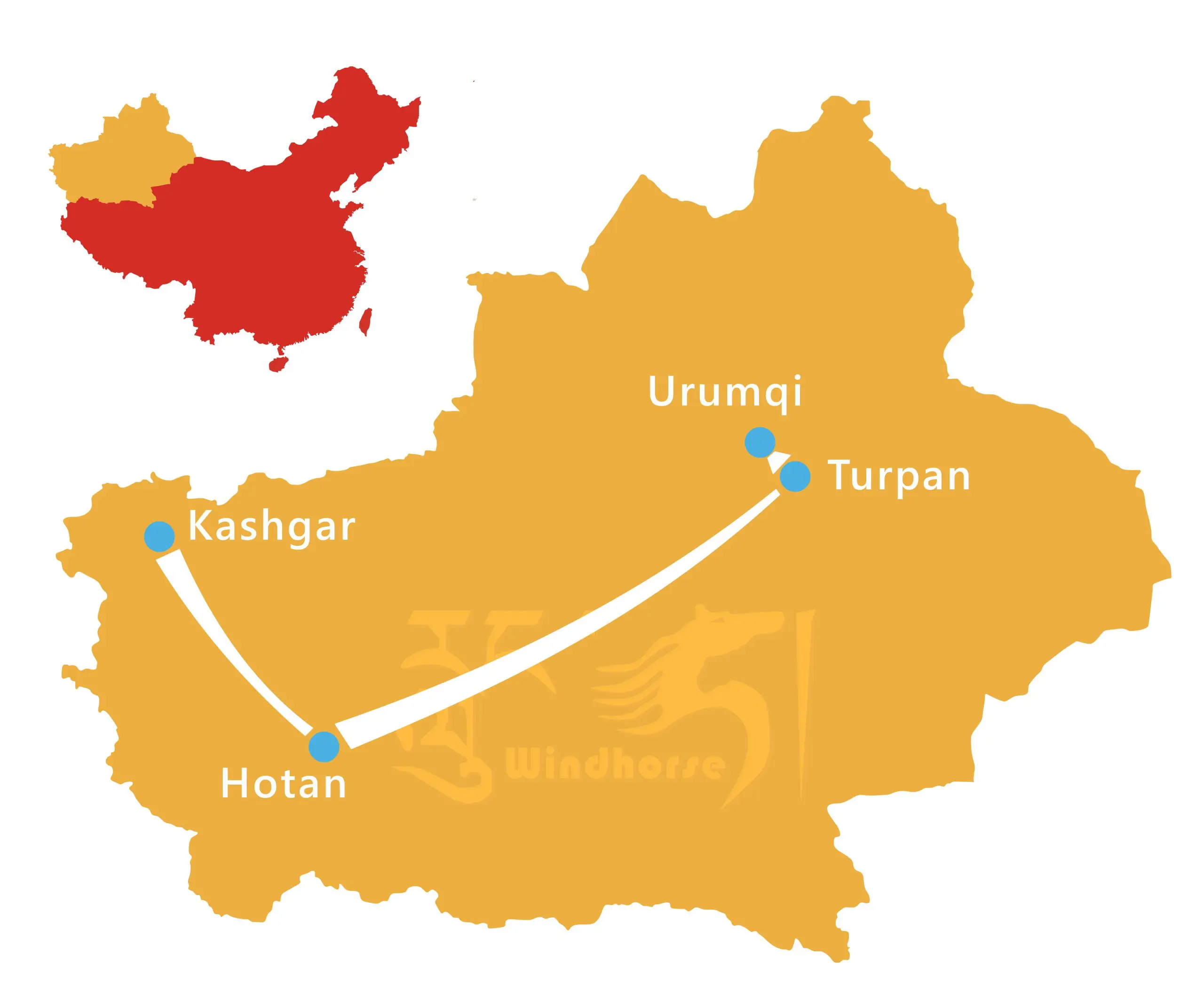


This Xinjiang Silk Road Cultural Tour travels from Urumqi to Turpan, Hotan, Yarkand, Kashgar, and Tashkorgan. Experience desert camping, oasis ruins, the Karakoram Highway, Karakul Lake, and rich Uyghur and Tajik culture.