
China Geography Overview: Facts, Regions, and Physical Landscape
China Geography Overview
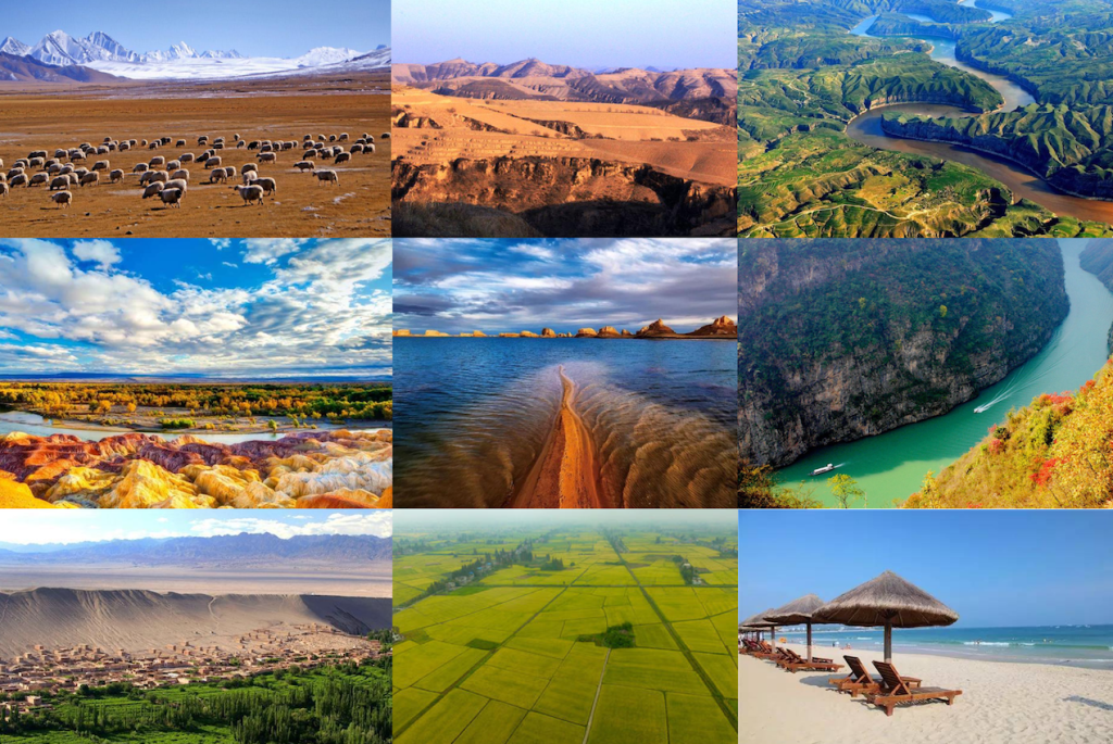
China, located in East Asia on the western coast of the Pacific Ocean, is the third largest country in the world by area, after Russia and Canada, covering 9.6 million square kilometers across roughly 50 degrees of latitude. The terrain ranges from the Tibetan Plateau at over 4,000 meters in the west to coastal plains barely above sea level in the east, with deserts, karst mountains, river deltas, and alpine grasslands in between. This physical diversity is the underlying reason why climate, food, architecture, and language vary so dramatically from one region to the next.
This page is a structured geographic reference covering topography, regional divisions, mountains, plateaus, plains, rivers, lakes, deserts, and coastline. For how these landscapes affect travel conditions in practice, see the companion article: China’s Diverse Landscapes: A Geographic Guide for Travelers.
Table of Contents
Fast Facts
China is the world’s third largest country by total area and, as of 2025, the most populous nation on earth. The figures below are the standard references used in geographic and academic literature.
| Official Name | People’s Republic of China |
| Capital | Beijing |
| Population | Approx. 1.41 billion (2025 estimate) |
| Total Area | 9,596,961 km² (3,705,407 sq mi) |
| Official Language | Standard Chinese (Mandarin /Putonghua) |
| Currency | Chinese Yuan / Renminbi (CNY / RMB) |
| Form of Government | Unitary one-party socialist republic |
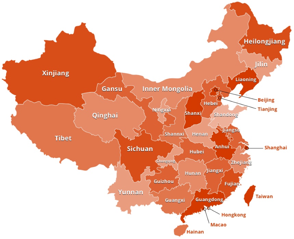
| Administrative Divisions | 23 provinces, 5 autonomous regions, 4 direct-controlled municipalities, 2 Special Administrative Regions (Hong Kong and Macau) |
| Land Borders | 14 countries — the most of any nation in the world. Borders include Russia and Mongolia to the north, Kazakhstan, Kyrgyzstan, Tajikistan, and Afghanistan to the west, Pakistan, India, Nepal, and Bhutan to the southwest, and Myanmar, Laos, Vietnam, and North Korea to the south and southeast. |
| Climate | Highly varied; dominated by dry seasons and monsoon cycles. Divided by the Qinling–Huaihe Line — Temperate North vs. Subtropical South. Pronounced temperature differences between summer and winter across all regions. |
| Coastline | Approx. 18,000 km along the Pacific Ocean, bordering the Yellow Sea, East China Sea, and South China Sea |
Topographic Features
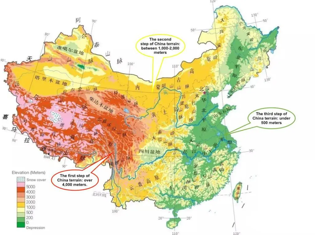
China’s terrain descends in three broad elevation steps from west to east, a pattern geographers refer to as the Three-Step Staircase (三级阶梯, sān jí jiētī). The first and highest step is the Tibetan Plateau, averaging above 4,000 m. The second step covers the interior plateaus and basins at 1,000 to 2,000 m, including the Loess Plateau, the Yunnan-Guizhou Plateau, the Sichuan Basin, and the desert basins of Xinjiang. The third step is the eastern plains and coastal regions, falling below 500 m, where the majority of China’s population lives. All major rivers follow this gradient, flowing west to east toward the Pacific.
Regional Divisions and the Heihe-Tengchong Line
China’s 34 provincial-level administrative units are typically grouped into five macro-regions based on physical geography: the Northeast Plain, the North Plain, the Southern Hills, the Xinjiang-Mongolia region, and the Qinghai-Tibetan Plateau. The first three together form Eastern China, also called the Eastern Monsoon Area, which contains the majority of China’s agricultural output and approximately 95 percent of its population, owing to its fertile terrain and favorable climate. The Xinjiang-Mongolia and Qinghai-Tibetan Plateau regions cover about 55 percent of China’s total land area but hold far fewer people due to their extreme elevation, aridity, and challenging terrain.
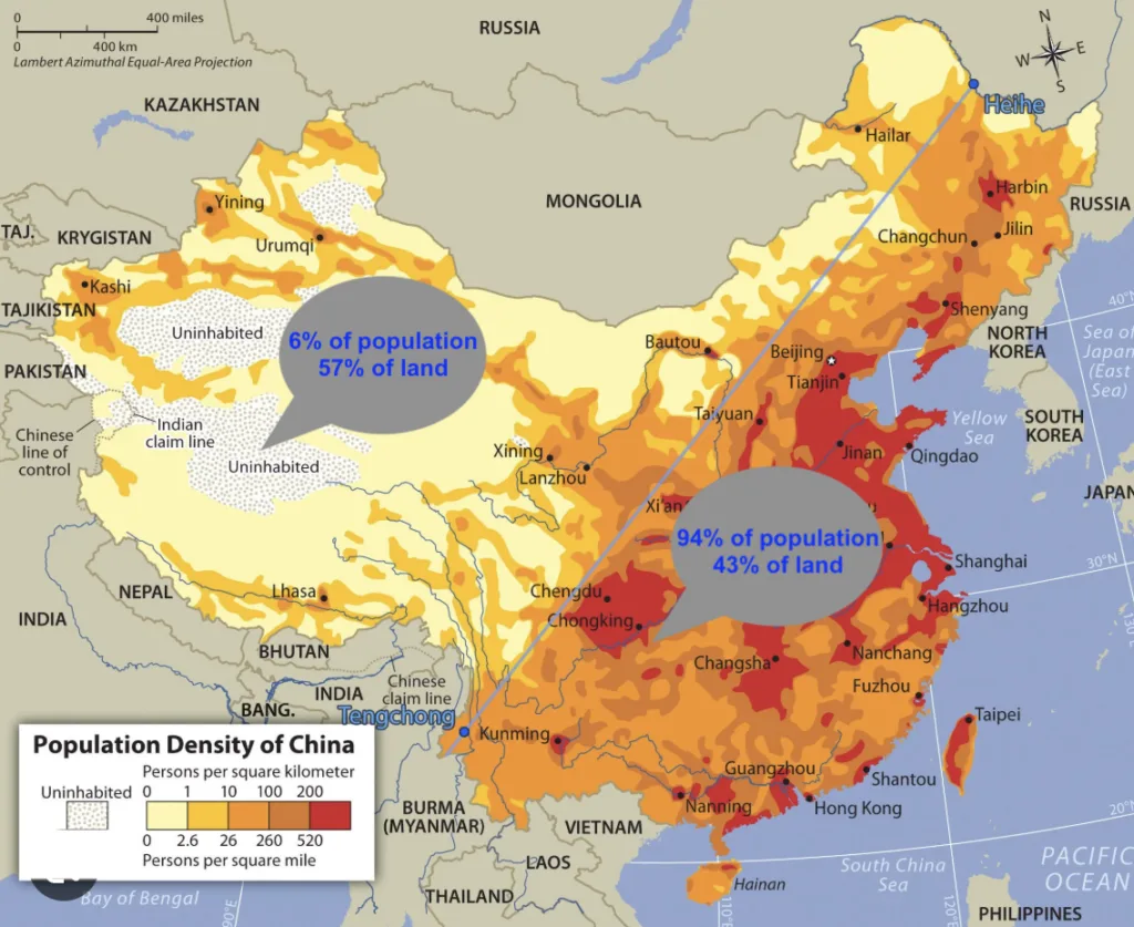
The Heihe-Tengchong Line
The most important demographic boundary in Chinese geography is the Heihe-Tengchong Line, also known as the Hu Line, proposed by geographer Hu Huanyong in 1935. It runs diagonally from Heihe in Heilongjiang province in the northeast down to Tengchong in Yunnan province in the southwest. The land east of this line accounts for roughly 43 percent of China’s total area but is home to approximately 94 percent of the population. The vast western territory, covering Xinjiang, Tibet, Qinghai, and western Inner Mongolia, holds just 6 percent of people across 57 percent of the land. This distribution has remained remarkably stable for decades and is one of the most cited examples of uneven population geography in academic literature worldwide.
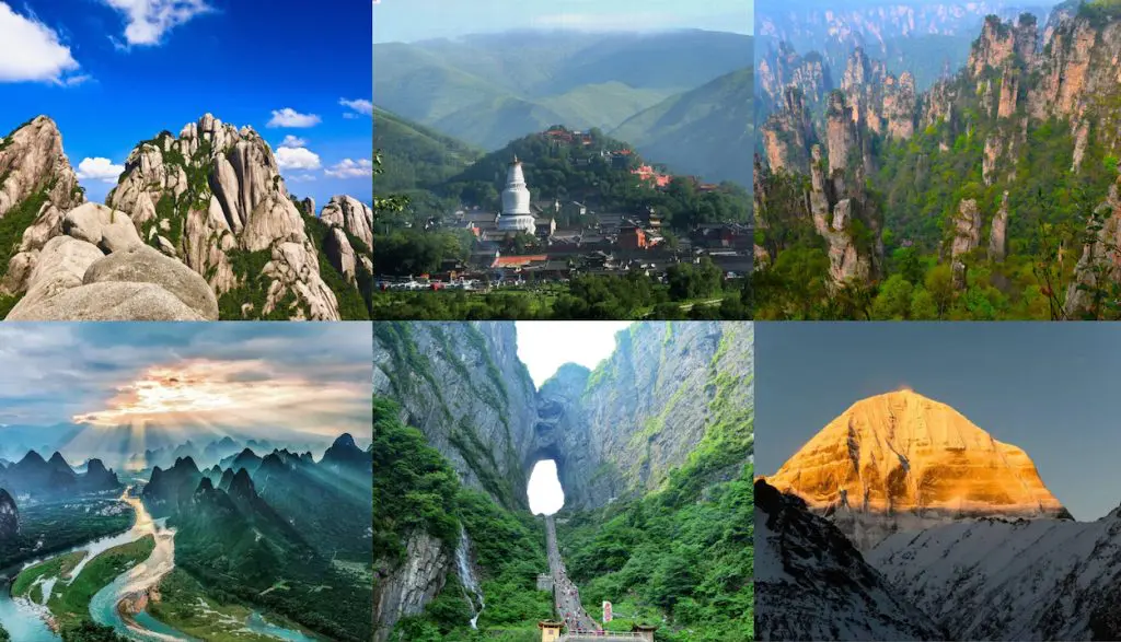
Mountain Ranges and Sacred Peaks
Mountains cover approximately 33 percent of China’s total land area, and seven of the world’s twelve peaks above 8,000 m are located within or on China’s borders. Mountain ranges running in different orientations form the structural framework of the country’s topography.
The principal ranges include the Himalayas along the southwestern border with Nepal, Bhutan, and India; the Kunlun Mountains forming the northern edge of the Tibetan Plateau; the Tianshan Mountains running east-west across central Xinjiang; the Qinling Mountains bisecting central China on an east-west axis; the Greater Hinggan Range in the northeast; the Taihang Mountains forming the eastern edge of the Loess Plateau; and the Hengduan Mountains in western Sichuan and Yunnan, where deep parallel river gorges run south toward Southeast Asia.
Beyond these structural ranges, China has a long tradition of sacred mountain sites. The Four sacred Buddhist mountains are Mount Wutai (Shanxi), Mount Emei (Sichuan), Mount Jiuhua (Anhui), and Mount Putuo (Zhejiang). The Four Sacred Taoist Mountains include Mount Wudang (Hubei), Mount Longhu (Jiangxi), Mount Qiyun (Anhui), and Mount Qingcheng (Sichuan). In Tibetan and Hindu tradition, Mount Kailash (6,638 m) in western Tibet is among the most sacred pilgrimage sites on earth. For mountain climbing, the most prominent destinations include Mount Huangshan (Anhui), Mount Huashan (Shaanxi), and Mount Tai (Shandong).
Plateaus and Basins
Plateaus cover approximately 26 percent of China’s landmass. The four major plateaus are distributed across the first and second steps of the topographic staircase.
The Qinghai-Tibetan Plateau is the largest and highest plateau in the world, with elevations ranging from 3,000 to over 5,000 m. It is bounded by the Kunlun Mountains to the north, the Himalayas to the south, and the Hengduan Mountains to the east. The plateau holds numerous glaciers, saltwater lakes, and the headwaters of Asia’s most important rivers. The Yunnan-Guizhou Plateau lies southeast of the Tibetan Plateau and averages around 2,000 m in elevation. It is characterized by limestone karst topography, including the stone forest landscapes of Yunnan and the river gorges of Guizhou. The Inner Mongolian Plateau curves across northern China at 900 to 1,500 m, dominated by rolling grasslands in the east and arid Gobi terrain in the west. The Loess Plateau sits between the Inner Mongolian Plateau and the Qinling Mountains, covering 640,000 km² at elevations of 1,000 to 2,000 m. It is blanketed in deep yellowish loess soil, the same sediment that gives the Yellow River its color and name.
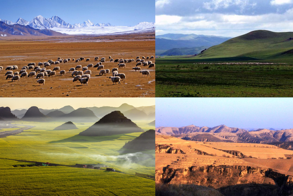
China’s major basins sit within the second topographic step. The Tarim Basin in southern Xinjiang is the largest basin in China, enclosed between the Kunlun Mountains to the south and the Tianshan to the north, and contains the Taklamakan Desert at its center. The Junggar Basin lies north of the Tianshan in Xinjiang and has a relatively cooler, semi-arid climate. The Sichuan Basin is ringed by mountains on all sides at elevations of 1,000 to 3,000 m, enclosing a lower interior of plains, hills, and low mountains — the most fertile agricultural zone in western China, and the location of Chengdu. The Turpan Depression in eastern Xinjiang contains Ayding Lake, China’s lowest point at 154 m below sea level.
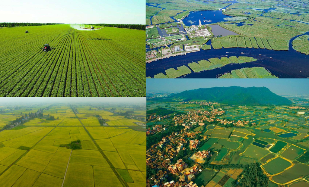
Major Plains
China’s major plains occupy the third topographic step along the eastern and northeastern parts of the country. These flat, fertile lowlands supported the development of China’s earliest agricultural civilizations and today contain its highest population densities.
The Northeast China Plain is the largest plain in China, stretching between the Greater and Lesser Hinggan Ranges and the Changbai Mountains. It is China’s primary grain-producing region. The North China Plain is an alluvial plain built by sediment from the Yellow River, Huai River, and Hai River. It includes the area surrounding Beijing and is one of the most densely populated agricultural zones in the world. The Middle-Lower Yangtze Plain is a classic floodplain formed by the Yangtze River and its tributaries. Its network of lakes and rivers makes it ideal for rice cultivation and freshwater fisheries, earning it the traditional description of “land of fish and rice.” The Pearl River Delta Plain in central-south Guangdong province is one of the wealthiest and most urbanized regions in the world, encompassing Guangzhou, Shenzhen, and the western side of Hong Kong.
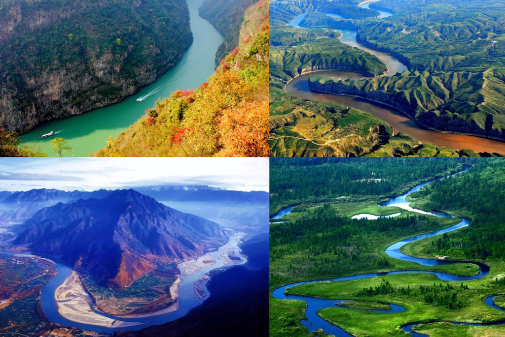
Rivers and Lakes
China possesses more than 1,500 rivers with drainage basins exceeding 1,000 km². Most of these major systems originate as glacial melt or monsoon runoff on the Qinghai-Tibet Plateau, flowing from west to east due to the country’s three-step topographic structure.
Yangtze River (Cháng Jiāng)
Asia’s longest and the world’s third longest river at 6,300 km, the Yangtze rises in the Tanggula Mountains and flows through eleven provincial-level regions before emptying into the East China Sea near Shanghai. It serves as China’s primary east-west transport artery. The Three Gorges Dam, located on this river in Hubei, is the world’s largest hydroelectric power station by installed capacity. Major tributaries include the Min, Jialing, Han, and Xiang rivers. The Huangpu River, which defines the Shanghai skyline, is the Yangtze’s final tributary before the sea.
Yellow River (Huáng Hé)
Often called the “Mother River” and the “Cradle of Chinese Civilization,” the Yellow River is China’s second longest at 5,464 km. It originates in Qinghai, flows through nine provincial-level regions, and empties into the Bohai Sea in Shandong. The river carries an exceptionally high sediment load from the Loess Plateau, which gives it its distinctive color and name. This sediment has historically caused the riverbed to rise above the surrounding land in its lower reaches, leading to repeated catastrophic floods and at least 26 major course changes over recorded history.
Other Major River Systems
The Pearl River (Zhū Jiāng) drains southern China through Guangdong, Guangxi, and parts of Yunnan and Guizhou, emptying near Guangzhou and Hong Kong. Its delta is one of the most economically dense and urbanized regions in the world. The Heilongjiang (Amur) River forms the northeastern border between China and Russia. The Lancang River originates on the Tibetan Plateau and flows south through Yunnan into Southeast Asia, where it becomes the Mekong — one of the great rivers of continental Asia.
The Beijing-Hangzhou Grand Canal is the world’s longest and oldest canal, stretching approximately 1,794 km. It connects five major river basins (the Hai, Yellow, Huai, Yangtze, and Qiantang rivers), linking the agricultural south with the political centers of the north. Construction began in the 5th century BC and reached its full extent during the Sui Dynasty (581 to 618 AD). It remains partially navigable today and is a UNESCO World Heritage Site.
Lakes
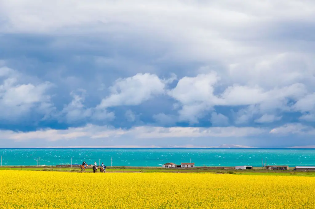
China has over 24,800 lakes, of which more than 2,800 cover at least 1 km². Freshwater lakes are concentrated in the middle and lower Yangtze region, including Poyang Lake (Jiangxi), Dongting Lake (Hunan), and Taihu Lake (Jiangsu). Saltwater lakes are more common on the Tibetan Plateau, including Qinghai Lake (the largest lake in China by surface area), Namtso Lake, and Manasarovar Lake near Mount Kailash in western Tibet.
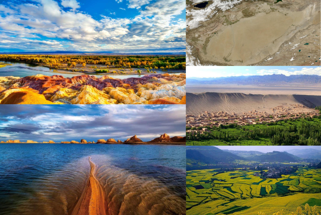
Deserts
Deserts cover more than 13 percent of China’s total land area, concentrated in the northwest. The two most significant are the Taklamakan Desert and the Gobi Desert.
The Taklamakan Desert occupies the center of the Tarim Basin in Xinjiang and covers approximately 337,000 km², making it the world’s second largest shifting-sand desert. It is an extreme desert environment with very low precipitation and high temperature variation between seasons. The ancient Silk Road oasis settlements of Kashgar, Hotan, and Dunhuang developed along routes skirting its edges, where underground water channels (karez) made agriculture and habitation possible.
The Gobi Desert stretches across northern China and southern Mongolia. Unlike the Taklamakan, it is largely a cold, rocky desert with some sand dune areas. It sits at a relatively high elevation of 900 to 1,500 m and experiences extreme seasonal temperature swings, from around 40°C in summer to below 40°C in winter in some areas. Historically, the Gobi formed a natural barrier that influenced the northern borders of Chinese civilization for centuries.
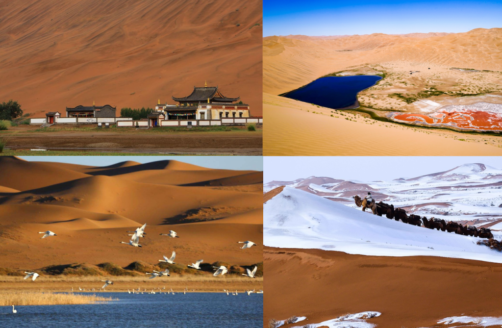
China has made significant investments in combating desertification since the 1970s. One notable result is the near-elimination of the Maowusu Desert in northern Shaanxi and southern Inner Mongolia through sustained tree planting and land stabilization programs. Deserts across China have been partially reclaimed over the past five decades, though new areas continue to be affected by wind erosion in the northwest.
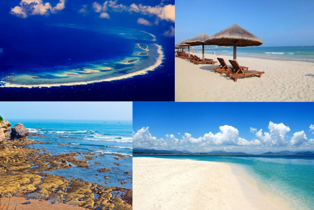
Islands and Coastline
China’s coastline runs approximately 18,000 km from north to south along the Pacific, bordering the Yellow Sea, East China Sea, and South China Sea. Nearly half of this coastline is sandy. The country has over 5,000 islands of varying size.
Taiwan Island is the largest island associated with China by area. Hainan Island, in the far south, is the second largest and the only tropical island province, known for its beaches and year-round warm climate. Chongming Island, at the mouth of the Yangtze River near Shanghai, is China’s third largest island and is largely designated as an ecological conservation zone.
Other notable islands include Gulangyu Island (Fujian), a car-free island known for colonial-era architecture and its density of pianos per capita; Weizhou Island (Guangxi), China’s largest and youngest volcanic island; and the Xisha Islands (Paracel Islands) in the South China Sea, which have been developed for limited tourism in recent years.
| Feature | Name | Key Data |
|---|---|---|
| Highest Peak | Mount Everest (Qomolangma) | 8,848.86 m, Tibetan Plateau border |
| Lowest Point | Ayding Lake, Turpan Depression | 154 m below sea level, Xinjiang |
| Longest River | Yangtze River | 6,300 km, empties near Shanghai |
| Largest Lake | Qinghai Lake | Saltwater, northeastern Tibetan Plateau |
| Largest Desert | Taklamakan Desert | 337,000 km², Tarim Basin, Xinjiang |
| Largest Plain | Northeast China Plain | Between Hinggan Ranges and Changbai Mountains |
| Largest Plateau | Qinghai-Tibetan Plateau | Avg. 4,000 m+, largest plateau on earth |
| Largest Basin | Tarim Basin | Southwest Xinjiang, contains Taklamakan |
| Largest Island | Taiwan Island | Pacific Ocean, east of Fujian |
Related tours

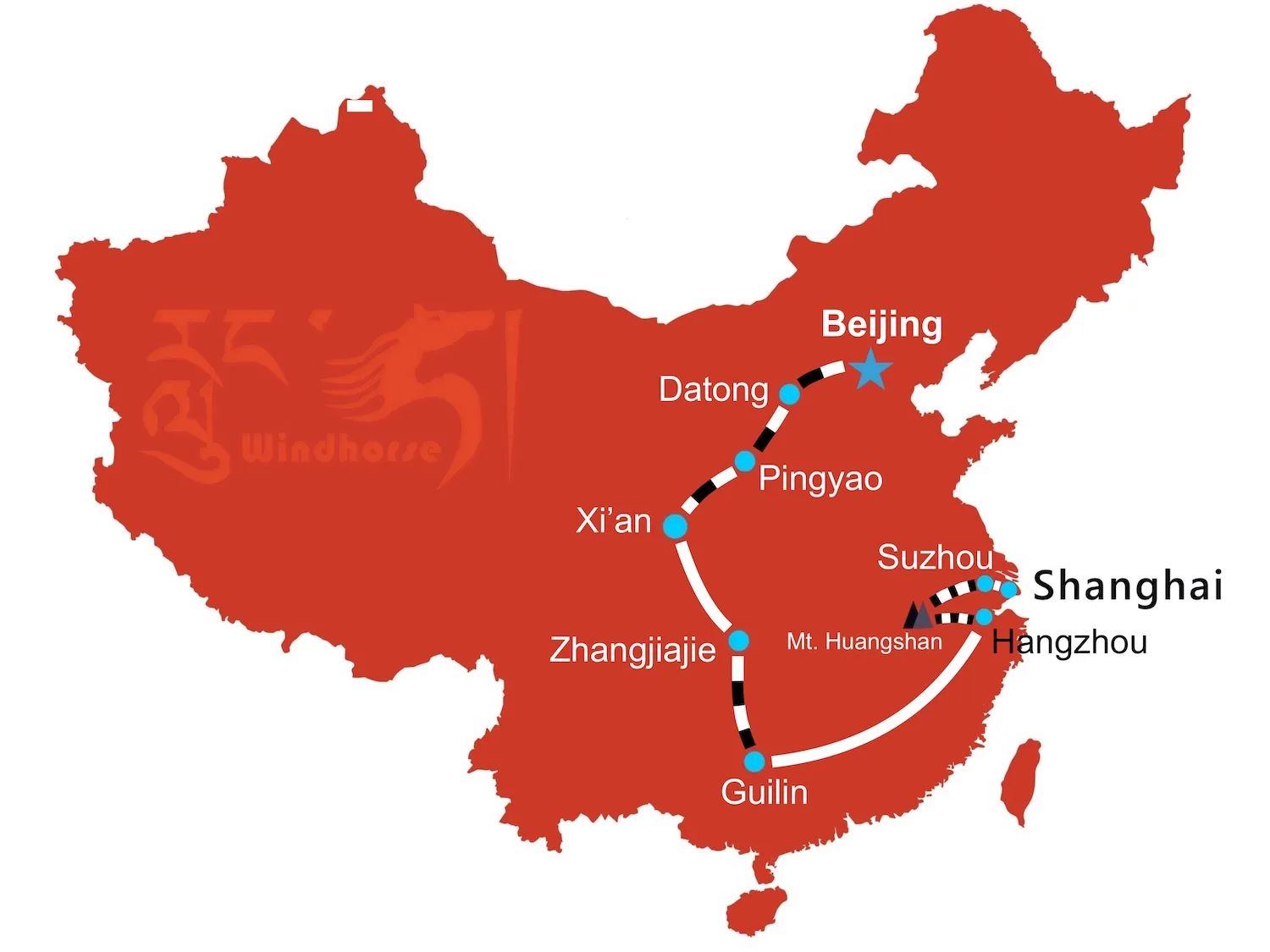


This 3 week China tour from Shanghai to Beijing connects the country’s most important cultural heritage sites with its iconic natural landscapes including Suzhou, Huangshan, Hangzhou, Guilin, Zhangjiajie, Xi’an, Pingyao, and Datong.
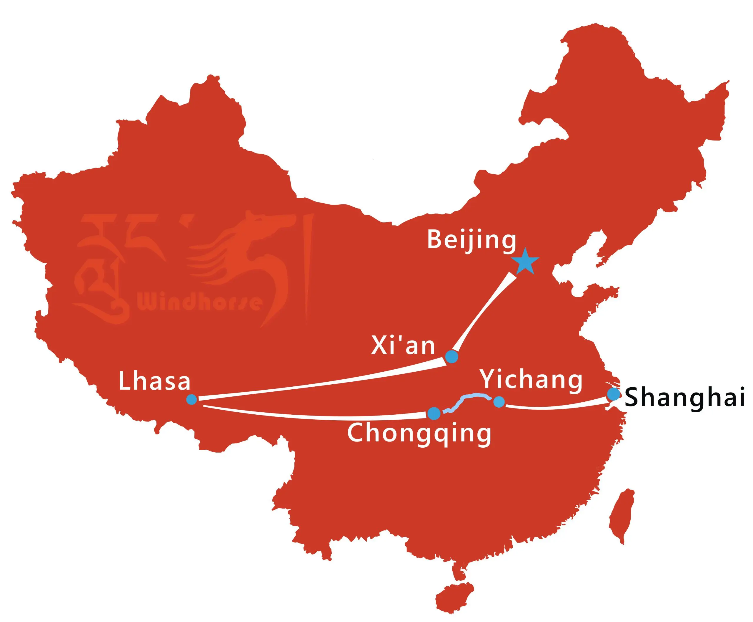


This 16-day China Tibet Tour with Yangtze River Cruise blends ancient history, highland culture, and natural beauty. Explore Beijing, Xi’an, Lhasa before cruising the Yangtze River through the dramatic Three Gorges to vibrant Shanghai.

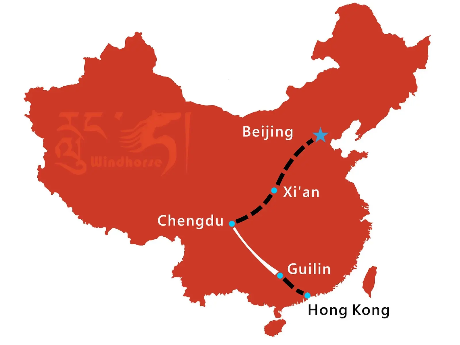


Experience China’s cultural and scenic highlights on this 13-day Essence of China tour from Beijing to Hong Kong. Explore the Great Wall, Terracotta Warriors, Chengdu pandas, Li River landscapes, and finish in vibrant Hong Kong for the perfect mix of history, nature, and modern city life.