Eastern Tibet (Kham)
Quick Facts about Eastern Tibet (Kham)
Geographic Location: Eastern Tibet, known as Kham, covers parts of the eastern Tibetan Plateau and stretches into the Sichuan, Yunnan, and Qinghai provinces of China.
Tibetan Name: ཁམས (Kham)
Chinese Name: 康区 (Kāng Qū)
Major Cities/Towns: Kangding, Chamdo, Derge, Lithang
Altitude: Varies widely, with elevations ranging from around 2,000 meters (6,560 feet) to over 4,000 meters (13,123 feet) above sea level.
Population: Predominantly ethnic Tibetans, with a mix of Han Chinese and other ethnic groups.
Language: Kham dialect of the Tibetan language, along with Mandarin Chinese.
Culture: Known for its unique Tibetan culture, distinct dialect, and vibrant festivals. Kham is also famous for its warrior history and horse-riding traditions.
Religious Significance: Home to many important Tibetan Buddhist monasteries, including Dzogchen Monastery, Derge Parkhang, and Ganden Thubchen Choekhorling Monastery.
Landscapes: Diverse landscapes ranging from high-altitude plateaus and snow-capped mountains to deep valleys and lush forests.
Best Time to Visit: From May to October, when the weather is milder and more accessible for travel.

Basic Introduction
Eastern Tibet (Kham), is a land apart from the rest of Tibet. Its climate, geography, flora, and fauna all lend it a unique, almost magical atmosphere. The scenery often resembles the Swiss Alps more than the high Tibetan Plateau. It is mainly the Chamdo region and the eastern part of the Nyingchi region, at the border with Sichuan, Qinghai, and Yunnan provinces. The population is 850,000 and the average altitude is over 4,000 meters.
It is centered on Chamdo, facing Sichuan Province in the east, bordering Yunnan Province in the southeast, bordering Myanmar and India in the southwest, bordering Qinghai Province in the north, and Lhasa in the west. Known as the "Pearl of Eastern Tibet".
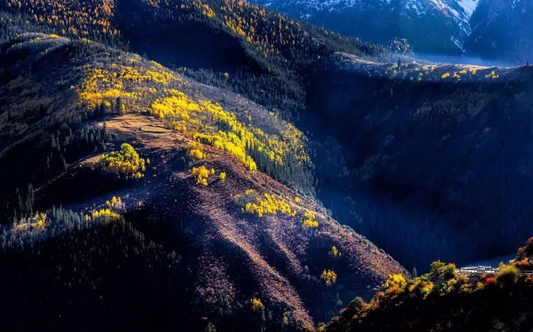
As the main and core area of Eastern Tibet, Chamdo is located in the bosom of mountains. Its Tibetan name means "Water Confluence". Chamdo has a long history, with the discovery of neolithic sites in 1977 and 1980, which indicates that as early as 5,000 years ago, here was inhabited by human beings and had formed primary villages. During the Tubo Period (7th-9th centuries AD), Chamdo was the seat of the famous "Dongnv Nation" (东女国) and the Supi Kingdom. Today, in Chamdo, you can still see the traces of the culture of the Tubo Period.
Chamdo has a plateau sub-temperate and a sub-humid climate. It is mild and humid in summer, dry and cold in winter. The annual temperature difference is small, but the daily temperature difference is large.

Why visit Eastern Tibet (Kham)
In addition to the vast and magnificent natural scenery and various lakes hidden behind a large number of human myths, there are also different Tibetan-style humanities and dense, high-cover forests in eastern Tibet. This is an unusually rich travel route, with snow-capped mountains, white glaciers, quiet lakes, lush forests, vast grasslands, galloping rivers, abundant wildlife resources, and profound Tibetan culture, the heavy history of the ancient Tea Horse Road.
If the Qinghai-Tibet Plateau is the third pole of the earth, what we should not ignore is the landform that the polar region should have glaciers. Eastern Tibet is not only the wettest part of the Qinghai-Tibet Plateau but also the most densely populated place of snowy mountains and glaciers.
Kham gains much of its charm from its people. You will find many people in eastern Tibet dress in sheepskin and with braided hair cruising the region on motorbikes. It can sometimes feel like America's Wild West, only with the cowboys and buffalos replaced by Khampas and yaks.


How to get and travel in Eastern Tibet
To see the landscape along the way to eastern Tibet, the best way is to make the overland trip from Lhasa either via the northern or via the southern route, and a loop route to cover both routes makes the best sense.
- The southern route heads eastwards to the gorgeous alpine lake of Basum-Tso, and then climbs over Serkhym-la pass for a breathtaking view of Namche Barwa, and then drop down to visit the picturesque turquoise lake Rawok-Tso bypassing Lulang forest. Crossing the Pomda Grassland before arrival at Chamdo to do a pilgrimage circumambulation at Galden Jampaling Monastery.
- From Chamdo, you could take the northern route to Lhasa as a return, bypassing Dêngqên and Baqên to Nagqu, slowly climbing to the high-altitude pasturelands, and visiting the very impressive and remote Riwoche Temple, Sok Tsanden Monastery, several other Buddhist and Bon Monasteries. Make a detour to the holy Namtso Lake from Nagqu before reaching Lhasa via Yangpachen hot spring.
- A shorter 5-7 days loop can be a nice try if travel time is limited. Heading east towards Basum-Tso lake and Lamaling Temple, then back west to Tsedang via Gyatsa, to visit the holy lake of Lhamo La Tso (if re-opens), then return back to Lhasa via Yarlung river after visiting Samye Monastery.

Top Attractions
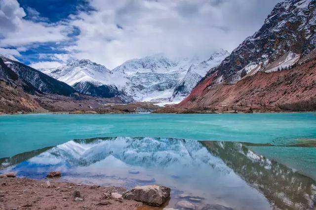
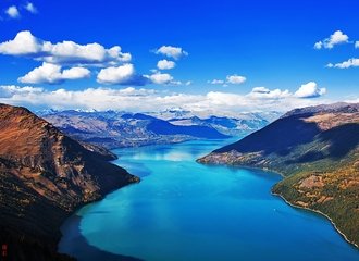
Lake Rawok-Tso: It is the largest lake in eastern Tibet and the main source of Parlung Zangbo River, a tributary of the Yarlung Zangbo River. Ranwu Lake is famous for its colorful beauty, the green grassland, the sky-blue lake water, and the white snow mountains constitute a very pretty watercolor.
Lhegu Glacier: The largest and widest glacier known in Tibet. It is a collective term for six glaciers. It’s like a paradise with many primitive Tibetan villages nearby. Visiting this ancient glacier is like returning to the ancient Ice Age, to wash away the secular dust and purify the soul.
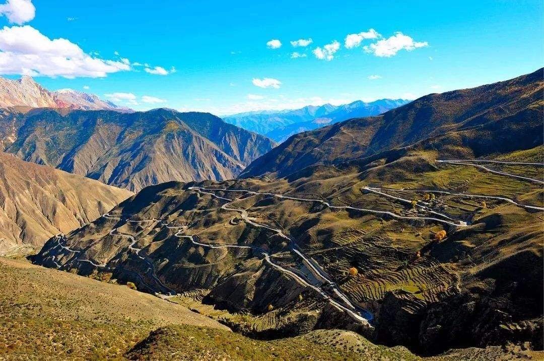
72 turnings of Salween River: It is the gyroidal highway in the mountains on the southern Sichuan-Tibet line. It is well-known for its dangerous roads in the world. According to the local saying, there are more than 130 turns at an average altitude of 4,618m.
Galden Jampaling Monastery: It is the largest in the Buddhist Gelugpa monastery in the Chamdo area founded in 1444. The biggest attraction of this monastery is the large-scale monks debating, where a thousand monks sit and debate under the tree.

Useful Travel Tips
- It’s available to travel all year round, and the best time is May, June, and September.
- If you see Tibetans sticking their tongues at you with a smile in the Chamdo area, it means humility and respect for you, not ridicule. You could simply smile at them politely.
- As a remote area of Tibet, Aliens’ Travel Permit and Military Permit are also required besides the entry permit, if you plan to visit the Nyingchi area and Chamdo area.



Comments
Is it possible to do your 14 day eastern loop tour at the moment? If so, what is the best time to travel?
In reply to Is it possible to do your 14… by Ken Edwards (not verified)
Dear Ken,
Thank you for your inquiry. This is Zoe from Windhorse Tour responding to your email.
I have already sent you the email with some tips for traveling in Tibet. With your replies and confirmation, I will provide a tour proposal and a quotation to you.
Thanks
Warm regards,
Zoe