
China's Diverse Landscapes: A Geographic Guide for Travelers
China’s landscape is among the most geographically diverse in the world. Spanning 9.6 million square kilometers and famously shaped like a “rooster” on the map, the country rises from the world’s highest mountains in the west to flat coastal plains in the east. After organizing tours here for nearly two decades, we’ve seen how these physical zones determine how people live, eat, and travel.
China’s Geography at a Glance:
- Tibetan Plateau: 4,000m+, home to Asia’s major rivers
- Interior Plateaus & Basins: 1,000–2,000m, where Jiuzhaigou and Zhangjiajie sit
- Eastern Plains & Coast: Below 500m, China’s urban heartland
As the world’s third largest country, China shares land borders with 14 neighbors, including Russia and Mongolia to the north, Nepal, India, and Bhutan to the southwest, Vietnam, Laos, and Myanmar to the south, and Kazakhstan and Kyrgyzstan to the west. This proximity creates the diverse ethnic cultures, languages, and cuisines found in China’s border regions.
For administrative regions and population data, visit our China Geography Overview. Below, we explore the physical landscape that creates such different travel experiences across China.
Table of Contents
From Tibet to the Coast: China’s Dramatic Elevation Drop
China’s landscape drops like a giant staircase from west to east. Geographers refer to this as the “Three Step Ladder” (三级阶梯, sān jí jiētī), descending from the Tibetan Plateau all the way to the Pacific Ocean.
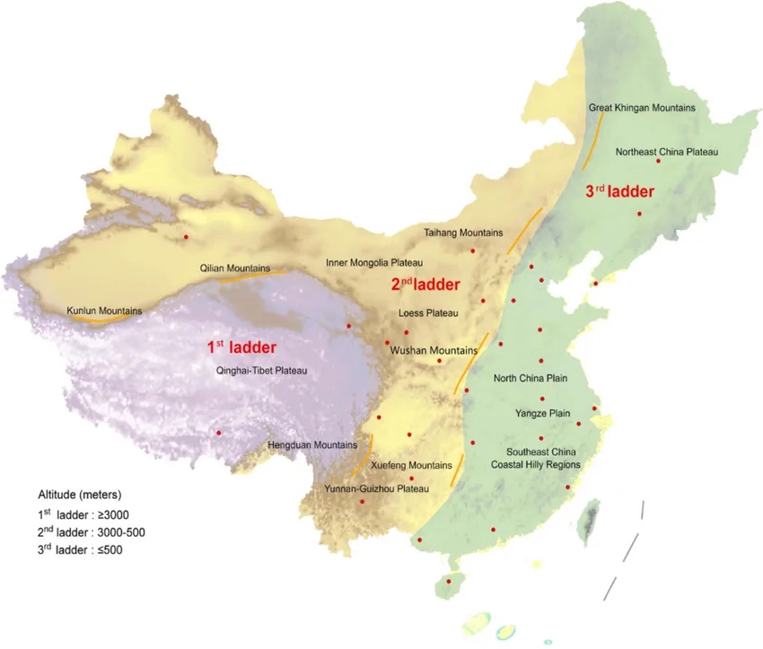
1st Ladder: The Tibetan Plateau – The Roof of the World
Average Elevation: Above 4,000 meters (13,123 ft.)
What Makes It Special: This is the highest plateau on Earth, formed where the Indian subcontinent crashed into Asia millions of years ago. The Himalayas border it to the south, the Kunlun Mountains to the north.
The “Water Tower of Asia”: Every major Asian river starts here: the Yangtze, Yellow River, Mekong, Brahmaputra, Indus, and Ganges all flow from these mountains.
Travel Reality: Everyone feels the altitude at this height. You’ll need 2 to 3 days to adjust in Lhasa (3,650m) before going higher to mountain passes above 5,000 meters. This is not optional at high altitude, it is a physiological necessity.
2nd Ladder: The Interior – Plateaus, Basins, and Valleys
Average Elevation: 1,000 to 2,000 meters
What’s Here: This middle zone includes huge basins (like the Sichuan Basin and Tarim Basin) and vast plateaus (the Loess Plateau and Yunnan Guizhou Plateau). This is where you’ll find Jiuzhaigou, Zhangjiajie, and the Zoige Grasslands.
Why It Matters: The Loess Plateau (640,000 sq km) is covered in thick yellow soil blown in by wind over thousands of years. This soil gives the Yellow River its color and name. Meanwhile, the Sichuan Basin is surrounded by mountains that trap moisture, creating constant mist and fog. This is why Chengdu gets only 1,100 hours of sunshine per year, less than half of most Chinese cities.
3rd Ladder: The Eastern Plains and Coast – China’s Heartland
Average Elevation: Below 500 meters
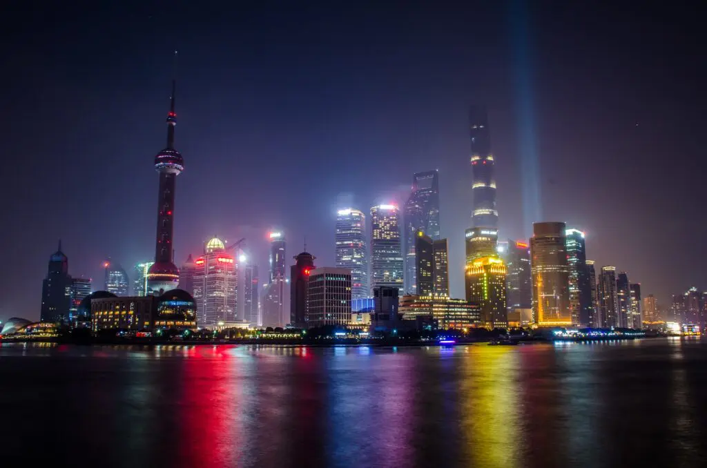
What’s Here: Stretching along an 18,000 km coastline, this region serves as China’s window to the Pacific. It includes three major areas: the Northeast Plain (China’s main farming area), North China Plain (where Beijing sits), and the Yangtze River Delta (China’s economic powerhouse including Shanghai).
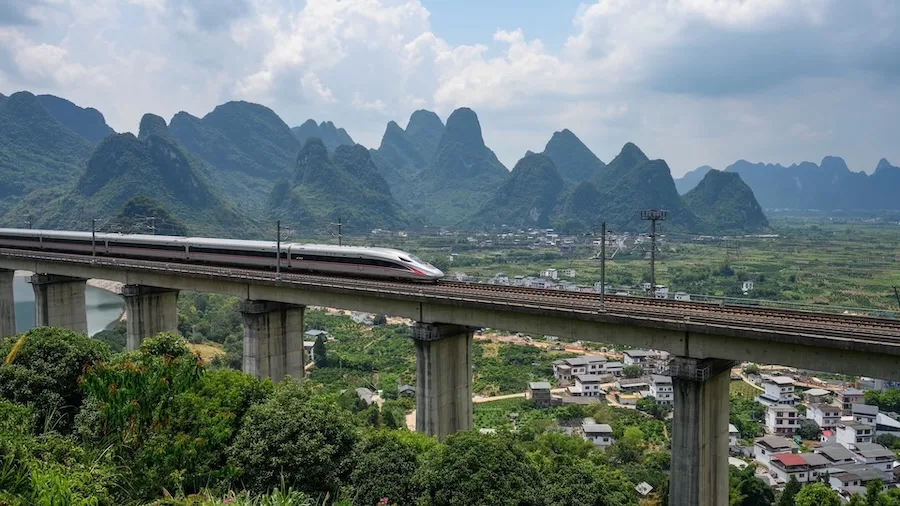
Why It Matters: These flat plains allow China’s high speed trains to operate at speeds up to 350 km/h, connecting Beijing to Shanghai (1,318 km) in just 4.5 hours. The extensive coastline also explains why coastal travel from Dalian in the north down to tropical Hainan Island in the south offers such varied experiences.
The North South Divide: Why Beijing and Shanghai Feel So Different
The Qinling Mountains and Huaihe River create China’s most important invisible boundary, dividing China into two major climate and agricultural zones.
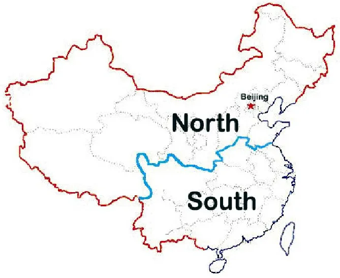
North of the Line:
- Climate: Cold, dry winters with less than 800mm of rain per year
- Farming: Wheat fields
- Food: This is “Noodle Country” where people eat dumplings, noodles, and steamed bread (mántou)
- Rivers: Freeze in winter, low water in dry season
South of the Line:
- Climate: Warm, humid with over 800mm of rain per year
- Farming: Rice paddies everywhere
- Food: This is “Rice Country” where rice, fish, and vegetables dominate
- Rivers: Flow year round with plenty of water
This line roughly follows where January temperatures hit freezing, making it the most important divide in Chinese life.
China’s Different Landscapes
| Landscape Type | Where to Find It | What Makes It Unique |
| Karst Mountains | Yunnan, Guizhou & Guangxi | Limestone peaks shaped over millions of years. Creates Guilin scenery. |
| Deserts | Inner Mongolia & Xinjiang | Taklamakan Desert (337,000 sq km), shifting sand dunes. |
| High Grasslands | Western Sichuan & Zoige | 3,400–3,600m meadows where Tibetan herders raise yaks. |
| Freshwater Lakes | Eastern Plains | Lakes regulate Yangtze flooding. |
China’s Great Rivers
China’s rivers all flow from west to east, following the natural downhill slope of the land.
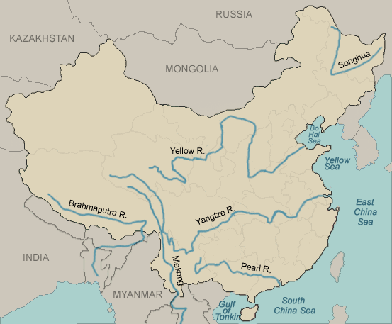
The Yangtze River (6,300 km): Asia’s longest river cuts through the Three Gorges, a dramatic series of deep canyons where the river slices through mountains to reach the lowlands. The Three Gorges Dam (completed 2006) is the world’s largest hydroelectric project.
The Yellow River (5,464 km): Called the “Mother River” (Huáng Hé), it carries up to 1.6 billion tons of yellow mud every year from the Loess Plateau. Over history, this river has jumped to a completely new course at least 26 times, causing devastating floods. That’s why it’s also called “China’s Sorrow.”
The Li River (83 km): A perfect example of a karst river, winding through limestone towers between Guilin and Yangshuo. The scenery appears on China’s 20 RMB note. Travel tip: Keep a 20 yuan note with you when you reach Xingping and you’ll see the exact same view.
The Pearl River (Zhū Jiāng): Southern China’s major waterway, forming a massive delta that includes Guangzhou, Shenzhen, and Hong Kong. This delta is one of the most densely urbanized regions on Earth.
Three Different Climates
China’s geography creates three completely different climate zones:
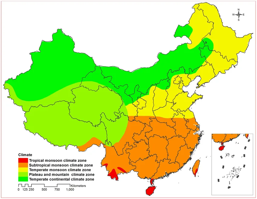
High Plateau Climate (Tibet & Qinghai): Intense sun, thin air, huge temperature swings between day and night. Lhasa gets 3,000 hours of sunshine per year, one of the sunniest places on Earth. The sun is much stronger at this altitude, so sunscreen is essential.
Inland Climate (Sichuan Basin, Yunnan Plateau, Zhangjiajie Region): Bigger temperature differences between summer and winter. The Sichuan Basin’s surrounding mountains trap moisture, creating persistent fog and clouds. This is why Chengdu stays gray and overcast while Jiuzhaigou, at higher elevation than Chengdu, often has clearer skies.
Monsoon Climate (Eastern China, Guilin, Yangshuo): Seasonal winds from the Pacific Ocean bring heavy rain from June to September, while winter stays relatively dry. This is why Guilin looks so green and lush; it gets over 1,900mm of rain every year.
What This Means When You Travel
Understanding China’s geography isn’t just interesting; it actually affects your trip.
Picking the Right Season: Southern China (Guilin, Yangshuo, Zhangjiajie) gets heavy rain June to September, while northern areas stay drier. Jiuzhaigou and Zhangjiajie are best in autumn (September to October) when the leaves change color and rain decreases. Summer temperatures across China can exceed 35°C in lowland areas, while high altitude destinations like Tibet and Jiuzhaigou stay cooler.
Getting Around: The flat eastern plains are perfect for high speed trains. You can reach most cities in 4 to 6 hours. But getting to Tibet or Qinghai from Chengdu requires either a flight or a long train ride that climbs gradually so your body can adjust to the altitude.
Dealing with Altitude: Trips to Tibet (above 3,500m), Jiuzhaigou (2,000 to 3,100m), or Zoige Grassland (3,400 to 3,600m) need extra time built in. Your body needs time to adjust as you climb higher. Building in buffer days is not optional at high altitude, it is a physiological necessity.
Combining Regions: Geography decides which places work well together. Chengdu pairs naturally with Jiuzhaigou (connected by high speed train). Beijing works with Shanghai (excellent train connections). But combining Tibet with coastal cities needs flights and careful planning for the altitude change.
How Geography Shaped Chinese Culture
China’s geography means every province feels different. The landscape has shaped:
What People Eat: The wheat versus rice split follows the Qinling Huaihe line almost perfectly. Northern restaurants serve more noodles and dumplings, while southern menus focus on rice. This pattern follows agricultural reality rather than culinary preference.
How Buildings Look: Northern homes (sìhéyuàn) have enclosed courtyards that block cold winds and keep heat in. Southern homes have open layouts with elaborate roof systems to drain heavy rain. Traditional Tibetan homes have thick walls and small windows to stay warm at high altitude.
Where Cities Grew: The flat eastern plains made farming easier and cities grew earlier. Mountain areas developed later, creating wealth gaps that still exist today. This is why China’s biggest cities are mostly along the coast.
Why Languages Differ: Mountains, especially in the south, kept communities isolated. This created many different languages even in small areas. Guangxi province, though relatively small, has multiple distinct dialects because mountains separate the valleys.
Frequently Asked Questions about China Geography
What is the “Three Step Ladder” in China?
The “Three Step Ladder” (三级阶梯, sān jí jiētī) describes China’s west to east elevation drop in three distinct zones. Step 1 is the Qinghai Tibet Plateau (4,000m+), Step 2 includes central basins and plateaus like Sichuan (1,000–2,000m), and Step 3 consists of the eastern plains and coast (below 500m). This stepped topography determines river flow direction (all major rivers flow west to east), climate patterns, high speed rail routes, and altitude acclimatization requirements for travelers.
Why is the Qinling Huaihe line important for travelers?
The Qinling Huaihe line divides China into northern and southern climate zones at approximately 33°N latitude. North of the line is colder and drier with wheat based foods like noodles and dumplings. South of the line is warmer and more humid, with rice based cuisine and water towns. This divide influences weather patterns, seasonal travel planning, what to pack, and regional food experiences.
What is the highest plateau in China?
The Qinghai Tibet Plateau is the highest plateau in China and the world, averaging over 4,000 meters (13,123 ft.). Known as the “Roof of the World” and the “Water Tower of Asia,” it includes Mount Everest (8,848.86m) on the China Nepal border. Due to extreme altitude, travelers should spend at least 48 to 72 hours acclimatizing in Lhasa (3,650m) before ascending to higher mountain passes above 5,000 meters.
Why are northern and southern Chinese foods so different?
Northern and southern Chinese cuisines differ because of climate and agricultural conditions determined by the Qinling Huaihe line. The north receives less than 800mm annual rainfall and grows wheat in its drier climate, making noodles and dumplings staples. The south receives over 800mm annual rainfall and has warmer, wetter conditions that support rice farming. This geographic split created the long standing “Noodle vs. Rice” cultural divide that has persisted for over 2,000 years.
Which part of China has the highest altitude?
Western China has the highest altitudes, particularly the Tibetan Plateau and the Himalayas. This region includes Mount Everest (8,848.86m), the world’s highest peak, and extensive areas sitting above 3,500 meters elevation. Major high altitude destinations include Lhasa (3,650m), Everest Base Camp (5,200m), and numerous mountain passes exceeding 5,000 meters. Travel here requires gradual ascent and proper acclimatization to avoid altitude sickness.
Final Words
From the high mountain glaciers of Tibet to the humid rice fields of the south, China’s dramatic geography affects everything: food, buildings, language, and economic development. Understanding these physical zones helps explain why traveling through China feels like visiting multiple countries.
The next time you eat dumplings in Beijing or rice in Guangzhou, remember: you’re not just tasting regional food, you’re tasting geography itself.
Related Reading:
- China Geography Overview – Provinces, regions, and demographics
- Best Time to Visit China – When to visit different regions
- Chinese Regional Food – How geography shapes what people eat
Related tours

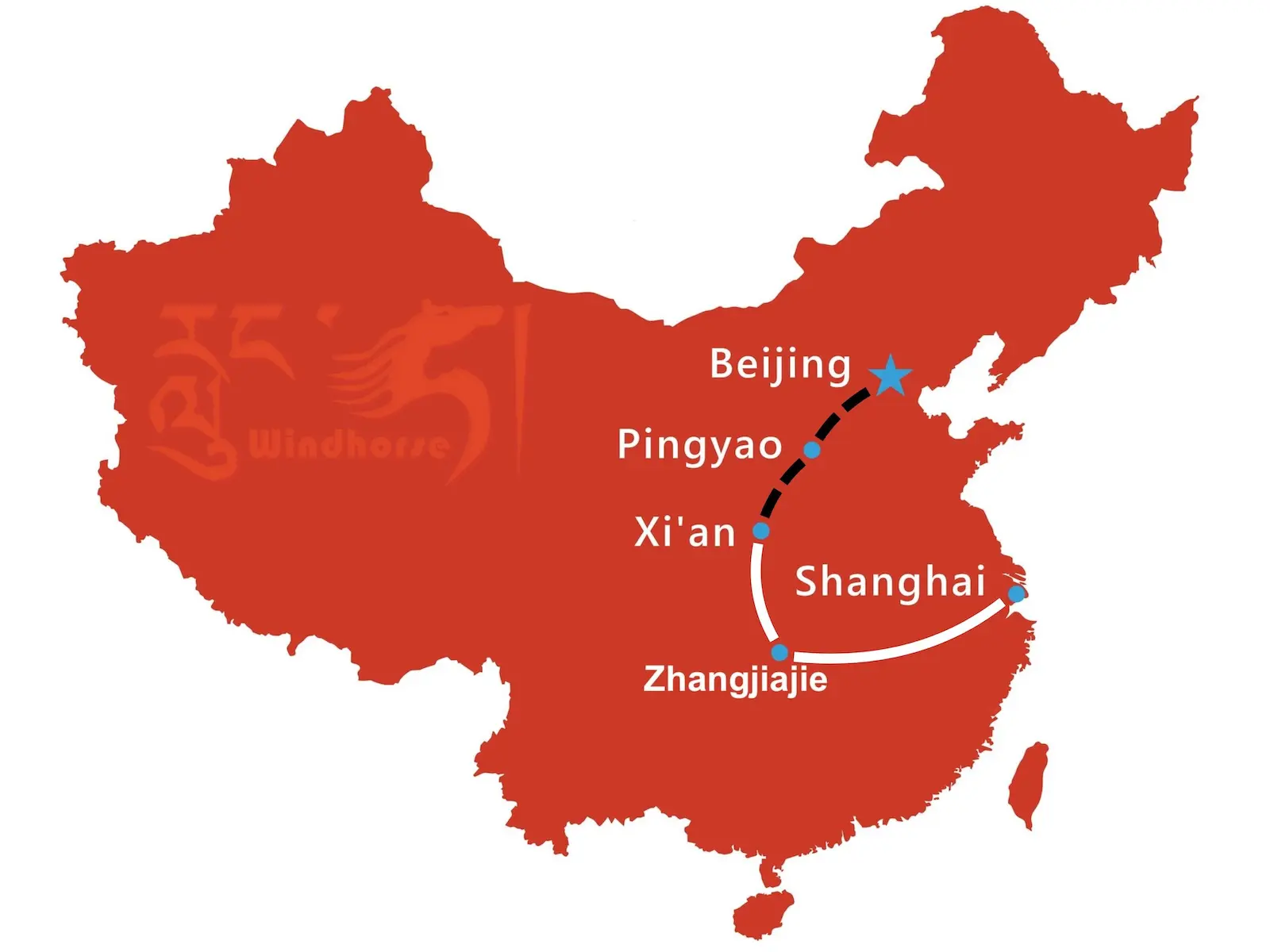


Experience China on this 2 week Beijing Xi’an Zhangjiajie Shanghai tour. Explore Beijing’s highlights, Pingyao Old Town, the Terracotta Warriors, Zhangjiajie’s Avatar Mountains, and Shanghai’s modern skyline for a balanced culture and nature journey.

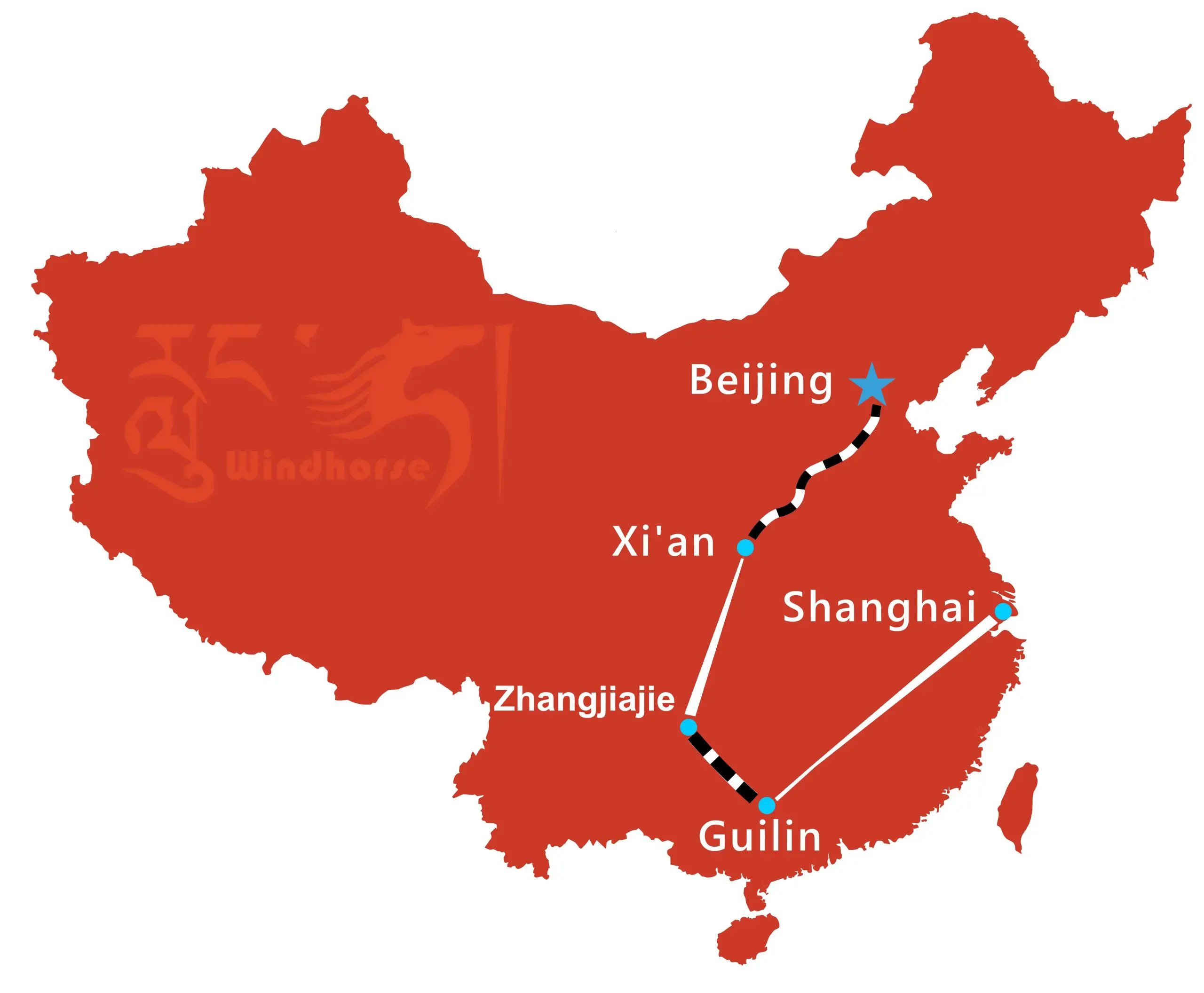


This 14-day China tour with Zhangjiajie and Guilin covers Beijing, Xi’an, Zhangjiajie, Guilin, and Shanghai. Walk along the Great Wall, see the Terracotta Warriors, cruise the Li River, and marvel at Zhangjiajie’s sandstone peaks, the perfect 2-week China itinerary for first-time travelers.


Experience the best of China and Tibet on this 2 week China Tibet Highlights Tour. Visit the Great Wall, Terracotta Army, Potala Palace, and pandas. A perfect mix of history, culture, and nature across Beijing, Xi’an, Lhasa, Chengdu, and Shanghai, perfect for first-time China Tibet travelers.