Tibet Mountains and Mountain Ranges in Tibet
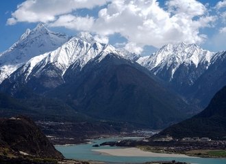
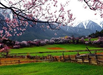
Tibet is an amazing region that, for many years, attracts tourists for its beautiful mountains and mountain ranges.
There are so many famous mountains that, with its high altitude, are great tourist attractions, not only for the adventurers who are seeking adrenaline but also for all travelers who want to explore the uniques and beauties in Tibet.
Tibet mountains are divided into two types, east-west and south-north mountain ranges.

Himalayas
The Himalayas are a mountain range in Tibet that everyone has heard about. We all know that the Himalayas are the highest mountain range in the world.
Situated on the southern side of the Tibetan Plateau, these mountains formed an arc-shaped mountain system with an approximate east-west direction with a total length of 2,400 kilometers from east to west and with a width of about 200-300 kilometers from south to north. It consists of many parallel mountain ranges, the central part of which is on the border between China, India, and Nepal.
The Himalayas are major tourist attractions in Tibet. It would be nice to travel to Tibet and to see any of these amazing mountains.
The most popular way to see the majestic view of the mountain is by trekking. However, some of the mountains are reachable only by driving. Many tourists choose trekking tours because that is one of the ways to feel the real Tibet and its beauty.
Also, you can have a bike trip, or simply you could arrive in a car to the Base Camps and to enjoy the view.
Highest Mountains in the Himalayas
The average altitude of the mountains is more than 6,000 meters. In the meantime, there are many peaks, and there are more than 50 mountain peaks over 7,000 meters above sea level and 11 mountain peaks over 8,000 meters above sea level.

Mount Everest
Mount Everest is the world's highest mountain and the main peak of the Himalayas, with an altitude of 8,848 meters. The Tibetan name for Mount Everest is Qomolangma, which means "Mother of the Earth."
Mount Everest is situated on the border between China and Nepal. It has two sides, and one is from Nepal, the south side, and the other is the Northside in Tibet.
The south side has an altitude of 5,364 meters (17,598 ft), while the Northside is at 5,150 meters (16,900 ft).
One of the reasons why so many tourists visit Tibet is because of Mount Everest and its Base Camp, from where there is an amazing view over the mountain. Even tourists can not climb to Everest Base Camp, the highest point where you can go is Rongbuk Monastery, the view from there is also breathtaking.
The best time to visit Mount Everest is in spring and autumn. If you decide to visit Mt.Everest in spring, you should consider traveling in April, or May. And if you prefer to go in autumn, then you should book your trip for September or October.
The best way to get to Rongbuk Monastery from Old Tingri is by driving. This is because the trekking to Rongbuk from Old Tingri is not so attractive as the trails are mainly paved roads. There are many tour packages that can offer a nice tour to Rongbuk Monastery.
Mount Lhotse
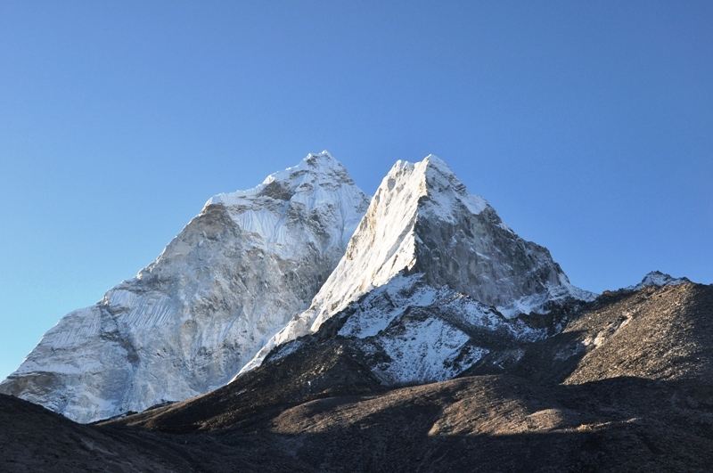
Lhotse is the second largest mountain in the Himalayas with an elevation of 8,516 meters (27,940 ft), and it is the fourth highest mountain in the world after Mount Everest, K2, and Kanchenjunga.
Mt. Lhotse is located a few kilometers from the Everest summit. It is located between China and Nepal, the east side of the mountain is in Tibet, and the west side belongs to Nepal.
Most climbers attempting Everest from the Nepal side go up the Lhotse Face to the South Col before reaching the top of Everest. And when it came to reaching the top of the Lhotse, many climbers through the years attempted to reach the top, and unfortunately, some of them ended tragically.
A Swiss team submitted the first ascent of the main summit on May 18, 1956.
If you want to have the best view of Lhotse, you should probably get to Kangshung Valley, an area east of Mount Everest. There are few trekking packages for this route. If you are an adventurer, you should definitely book one of the offered packages and enjoy your adventure.
Makalu
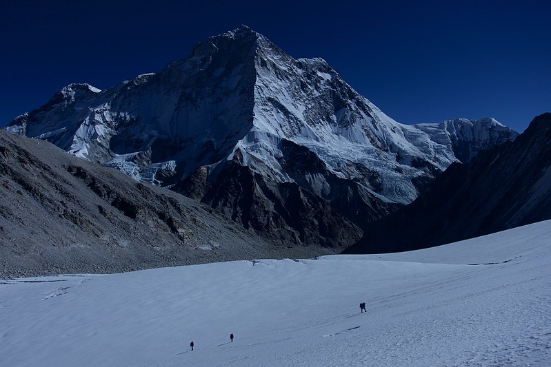
Makalu is recognized as the fifth highest mountain in the world. It has an elevation of 8,485 meters (27,838 ft).
It is located 19 km (12 mi) southeast of Mount Everest in the Mahalangur Himalayas, between Nepal and Tibet.
Makalu has a shape as a four-sided pyramid, and it is one of the eight-thousanders. Makalu has two notable subsidiary peaks, Kangchungtse, or Makalu II, at an elevation of 7,678 m and Chomo Lonzo with an altitude of 7,804 m.
This amazing mountain is one of the difficult mountains to climb in the world. The American team led by Riley Keegan was the first climb on the mountain in 1954. If you are not a climber, but you still want to see the beauty of the Makalu, you should go on Kangshung trek. The most visited place to get an amazing view of Makalu is the Geu La Pass.

Mouont Cho Oyu
Cho Oyu is the sixth-highest mountain in the world with an elevation of 8,188 meters (26,864 ft) above sea level. In Tibetan language, Cho Oyu means "Turquoise Goddess.”
As part of the Himalayas Cho Oyu, the same as Mount Everest and other mountains in the Himalayas is located on the border between China and Nepal.
The mountain was first climbed by Herbert Tichy, Joseph Jochler, and Sherpa Pasang Dawa Lama of an Austrian expedition on October 19, 1954.
If you take a trek to Mount Everest, and every trekking route starts from Old Tingri, you will be able to see the fantastic Cho Oyu from there. Yes, you don’t need to climb the mountain, you can feel the mountain from a distance, and it is majestic.
Gangdise- Nyechen Tanglha
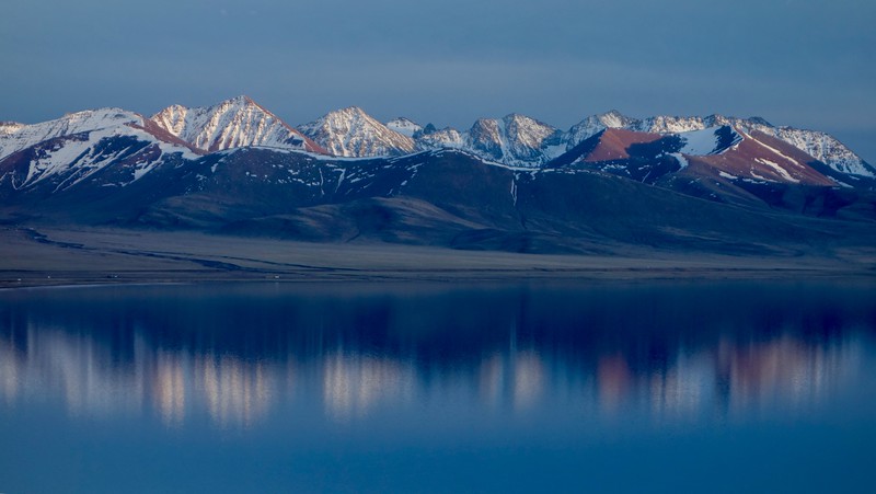
Gangdise- Nyenchen Tanglha is a massive mountain range located in the central part of Tibet. The mountains extend across east and central Tibet and are the continuation of the Gangdise Mountains to the east. The southeast extension is connected to the Bosula Mountains in the southwest of the Hengduan Mountains.
The Nyainqentanglha Mountains are also the most significant glacial area in the southeast of the Tibetan Plateau.
This mountain range has mountains with an average altitude of more than 6,000 meters, and the mountain range itself is 1400 kilometers long, with an average width of 80 kilometers, and an elevation of 5000-6000 meters. The main peak is Nianqing Tanggula Peak, with an altitude of 7,111 meters above sea level, and it is snowy all year round.

Mount Kailash
The main peak on Gangdise mountains is Mount Kailash, with an elevation of 6,656 meters.
Mount Kailash is the most sacred mountain for four religions: Hinduism, Buddhism, Jainism, and Bon.
Mount Kailash is the only mountain in this region that is never climbed by man. There were some attempts, but all of them ended without success. Even the Chinese Government has forbidden climbing Mount Kailash.
Most of the reasons why it isn't climbed are the major sacred meaning for Tibetans, but also for the people who are following the mentioned religions.
Every year, thousands of pilgrims go on Kailash Kora, which is a trekking route around the mountain with a distance of around 52 kilometers. After circling the mountain, the pilgrims visit Lake Manasarovar, which is one of the three sacred lakes in Tibet. They are taking baths in the lake, believing that their sins will be cleansed.
Kailash Kora trek includes not just the pilgrims, but also many tourists. We can say that this trekking route is one of the most popular in Tibet.
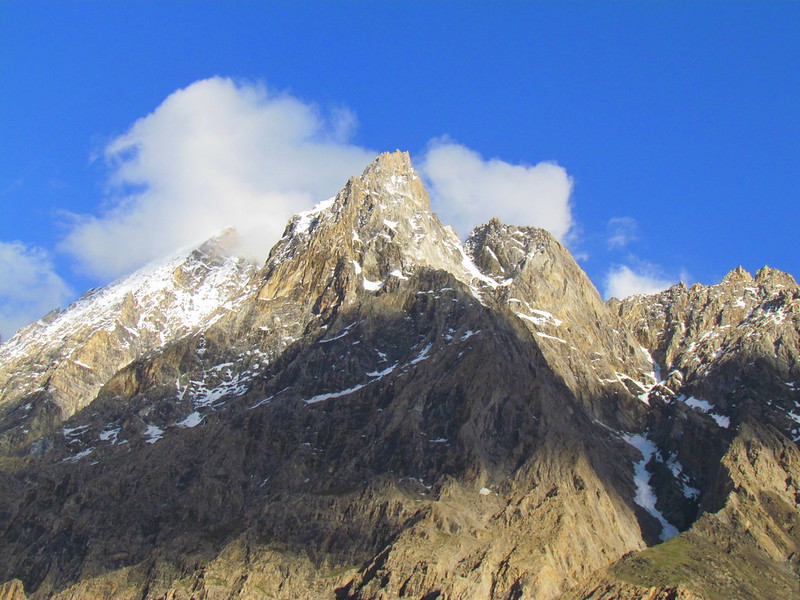
Karakoram Mountain Range
The Karakoram Mountains are a trend between Tibet and Kashmir in China, and Punjab Hima Yashan Mountain (part of the Great Himalayas) is a massive parallel mountain range. It is also the second-highest mountain range in the world.
The Karakoram Mountains have an average altitude of more than 6,000 meters, with a total of 19 mountains exceeding 7,260 meters, eight peaks exceeding 7,500 meters, and 4 of them exceeding 8,000 meters. The peaks usually have sharp, steep shapes, snowy peaks, and immense glaciers. Hundreds of stone towers and peaks surround it.
Towering peaks and steep slopes characterize the terrain. The south slope is long and steep, and the north slope is steep and short. Cliffs and landslides (significant accumulations of large rocks) occupy a vast area. In the mountain valleys, chaotic rocky slopes are widespread.
There are 8 glaciers in the middle and low latitudes of the world with a length of more than 50 kilometers, of which 6 are in Karakorum with a total area of 18,600 square kilometers.
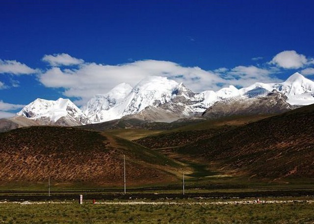
Tanggula Mountain Range
Tanggula Mountain is a mountain range that rises on a 5,000-meter plateau at an altitude of 6,839 meters. The top of the mountain is a quasi-plain of about 5,000 meters, and the ridge on the surface is above the snow line (the snow line is 5,300 meters). The western section of the Tanggula Mountains is in the Tibet Autonomous Region, and the eastern part is the boundary between Qinghai Province and the Tibet Autonomous Region. Its western end gradually submerges into the Qiangtang plateau, and the southeast is connected to the Tannenteng mountain range - Yunling mountain range in the Hengduan mountain range, with a total length of about 700 kilometers and a mountain width of more than 150 kilometers.
Tanggula Mountain is also the watershed of the Yangtze River and Nu River and is connected to the Karakoram Mountains. The western part is the watershed of the central water system and the outflow water system in northern Tibet, and the eastern part is the watershed of the Indian and Pacific water systems.
If you are traveling with Qinghai-Tibet Railway from Mainland China to Tibet, you will cross the Tanggula Mountains at Tanggula Mountain Pass, which is the highest point of the Qinghai-Tibet Railway, and also the highest point of any railway in the world. The Tanggula Pass has an altitude of 5,072 meters (16,640 feet).
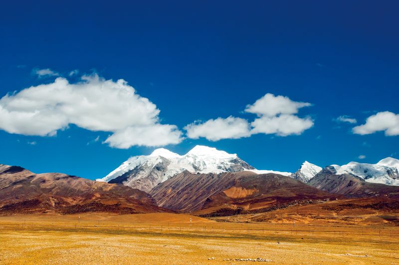
Kunlun Mountains
The mountain range extends from the east of the Pamirs Plateau in the west to Xinjiang and Tibet and extends to Qinghai. It has a total length of about 2,500 kilometers, an average altitude of 5,500-6,000 meters, a width of 130-200 kilometers, a narrow area in the west, and a wide area in the east.
The highest peak is the Liushi Shan, with the elevation of 7,167 meters (23,514 ft).
The Kunlun Mountains are higher in the west and lower in the east, and are divided into three sections: west, middle, and east.
According to the terrain: there are three peaks in the west of the Kunlun Mountain above 7,000, 7 peaks above 6,000 meters, with an average altitude of 5,500-6,000 meters;
There are eight peaks above 6,000 meters above sea level, with an average elevation of 5,000-5,500 meters, and the northern slope of the snow line is 5,100-5,800 meters.
Also, there are four peaks above 6,000 meters above sea level in East Kunlun Mountain, and eight peaks above 5,000 meters, with average altitude 4,500-5,000 meters, the snow is distributed on the mountain peaks above 5,800 meters.
There are so many natural attractions worth visiting around Kunlun Mountain, such as the Golmud River (Kunlun River), Kunlun Spring (Yao Chi), Kunlun Mountain Pass, and Yuxu Mountain and Yuzhu Mountain.
Kunlun Mountain Pass
Kunlun Mountain Pass has an elevation of 4,772 meters (15,492ft), and it is located about 160 km (100 miles) to the south of Golmud City. It’s also a core path for mountain climbers. For many adventurers, it is the first choice for trekking and climbing because of the opportunity to have majestic views over the snow-capped peaks and the vast grasslands.
Hengduan Mountain Range
The Hengduan Mountain range is located at the junction of the second and first steps of the Chinese terrain.
The dividing line between the first and second steps of the country. It is a general term for a series of parallel mountains in the north-south direction from the west of Sichuan and Yunnan provinces in China and the east of the Tibet Autonomous Region.
The altitude of the mountain range is mostly 4,000-5,000 meters, and the height difference of the mountain valley is generally above 1,000-2,000 meters. The average altitude is above 4,000 meters.
Mountains from west to east include Mishmi Mountain, Danbaqu, Mount Gangigab, Chayu River, Besula Mountain - Gaoligong Mountain, Tanian Taung Mountain-Nu Mountain, and Mangkang Mountain (Tranquility Mountain)-Yunling Mountain, Queer Mountain-Sharuli Mountain, Daxue Mountain- Zuoduo Mountain-Jinping Mountain, Qionglai Mountain-Dengshu Mountain-Daliang Mountain, etc.
Attractions near Hengduan Mountain range
There are so many beautiful natural attractions in the Hengduan Mountain range, such as valleys, snowy peaks and glaciers, forest meadows, waterfalls, and hot springs.
Most of the attractions for tourists around these mountains aren’t in Tibet, but they are located in China. One of the popular attractions is also Jiuzhaigou Valley. If you are traveling to Tibet or in China, don’t miss having one day at this fairyland in Sichuan Province.
We can not miss mentioning Grand Leshan Buddha, the tallest sitting Buddha in the world.
Also, a great attraction is Emei Mountain, located in Sichuan Province, and it is one of the Four Sacred Buddhist Mountains in China.
Other popular locations for tourists are Huanglong, Daocheng, Lijiang, and many others.
Essential things to know before visiting Tibet mountains
There are some necessary things that every traveler should know if planning to visit Tibet and its mountains.
Documents
The first thing is that every traveler who wants to travel to Tibet should know that you can’t enter Tibet without a Tibet Travel Permit. That is a document issued by the Tibet Tourism Bureau. You can have the permit easily via your tour agency.
If you travel to specific areas in Tibet, such as Tsedang, Shigatse (Sakya Monastery, Mt. Everest, Rongbuk Monastery), Gyantse, Ngari Region (Mt.Kailash, Lake Manasarovar, Tsaparang, Years), Nyingchi Region, Chamdo Region (Chamdo, Riwoche, Tengchen) you will need Alien’s Travel Permit.
For regions such as Ngari, Nyingchi and Chamdo you will need also a Military Permit
Planning a tour
No one can travel in Tibet without a companion of a licensed tour guide. Also, every foreign tourist should have an organized tour and organized transportation with a driver.
The easiest way to manage this is to book a trip to Tibet with a local travel agency or a Chinese travel agency.
If you book a tour with us, we will arrange everything for you.
Altitude sickness
Altitude sickness is a condition that brings difficulty adjusting to lower oxygen pressure at high altitudes. Altitude sickness is also known as mountain sickness.
Altitude sickness typically occurs above 2,500 meters (8,000 ft). However, some are affected at lower altitudes, and the average altitude in Tibet is 4,500 meters (14,750 ft), and mountains are more than 5,000 meters above sea level.
The main symptoms are headache, dizziness, feeling tired, trouble sleeping, loss of appetite, nausea, or vomiting.
These mild cases can be treated with ibuprofen, acetazolamide, or dexamethasone.
Altitude sickness can have complications such as High altitude pulmonary edema (HAPE),
high altitude cerebral edema (HACE).
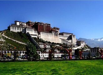
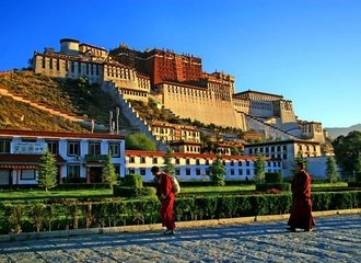
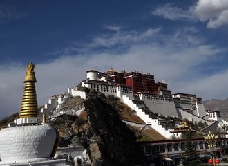
Before trekking or climbing, you should have proper acclimatization. The best way to get acclimatization is to travel to Tibet by train and spend a few days in Lhasa. Luckily, most of the tours began from Lhasa. Before you start the trekking route, you will stay for two or three days in Lhasa, and that is an excellent opportunity to visit the Potala Palace and other attractions in the city.


