
Geography of Tibet
Location
Tibet Autonomous Region is located at longitude 78 ’25’-99 ’06’ east and latitude 26 ’44’-36 ’32’ north on the southwest border of China and covers the majority of the Qinghai – Tibet Plateau. Bordering India, Bhutan, Nepal and Sikkim to the south and the west, Yunnan Province to the southeast, Sichuan Province to the east with Qinghai Province and Xinjiang Uygur Autonomous Region to the north, Tibet is the second largest region in China (after Xinjiang Uygur Autonomous Region), occupying a total area of over 1,200,000 sq m, at an average altitude of more than 4,000 m.
Tibetan Plateau
As part of the Qinghai – Tibet Plateau, and also known as the ‘Roof of the World’, Tibet is an amazing combination of scenery including mountains, plains, foothills and valleys. With the Kunlun and the Gangdise Mountains being respectively at its northern and southern ends, the land inclines from an average altitude of above 5,000 m in the northwest to about 4,000 m in the southeast, hence differing landscapes found in the different regions.
Key Regions within the Plateau
Tibet’s vast expanse is divided into several key regions, each offering distinct travel experiences and landscapes:
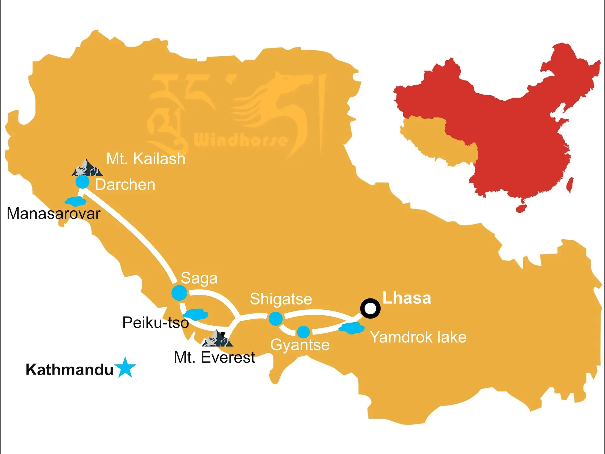
Lhasa
The capital city and spiritual heart of Tibet, Lhasa sits at an altitude of around 3,650 meters (12,000 feet). It is home to iconic landmarks like the Potala Palace, Jokhang Temple, and Barkhor Street. Lhasa is a major cultural and religious center, attracting travelers interested in Tibetan Buddhism and history.
Shigatse
Located around 3,800 meters (12,470 feet) above sea level, Shigatse is Tibet’s second-largest city. It is known for Tashilhunpo Monastery, the traditional seat of the Panchen Lama, and its proximity to Mount Everest. Shigatse serves as a gateway for those heading toward the Everest Base Camp.
Ngari
Situated in the far west of Tibet, Ngari is one of the most remote and sparsely populated regions on the plateau. Famous for Mount Kailash, a sacred peak revered in multiple religions, and Lake Manasarovar, Ngari attracts adventurers and pilgrims alike. The region’s altitude can reach over 5,000 meters (16,400 feet), making travel here both challenging and awe-inspiring.
Nyingchi
Often called the “Switzerland of Tibet,” Nyingchi is a lower-altitude area (around 3,000 meters or 9,800 feet) with milder climate and more greenery than other parts of Tibet. The region is known for its lush forests, valleys, and rivers, offering a different side of Tibetan scenery.
South Tibet
Mt. Everest soars to a height of some 8844.43m skyward and together with several other mountain ranges with an average altitude of 6,000 m, constitutes the Himalayan mountain range as the highest mountainous area in the south of Tibet. With the higher western end of this area being dry and freezing, the eastern region is temperate, humid and densely forested. Meanwhile, between the Himalayas and the Gangdise, the Yarlung Tsangpo River winds its way through this region leaving a fertile agricultural area of lakes, basins and river valleys along its course.
North Tibet
Vast plateaus in the north of Tibet, specifically around the Kunlun Mountain, the Tanggula Mountain and between the Gangdise and the Nyainqentanglha Mountains, cover 2/3 of the total area of Tibet. Dotted with numerous lakes and basins, the plateaus, among which Changthang Plateau is the best known, provide rich animal husbandry products for other parts of Tibet.
East Tibet
The tortuous ways of Nu, Lancang and Jinsha Rivers cut through the majestic Hengduan Mountain range, creating breathtaking landscapes of high mountains and deep canyons. Higher in the north and lower in the south, the mountain and canyon area in the eastern part of Tibet presents a wide diversity of fauna and flora as well as a unique combination of snow-capped peaks and verdant hillside forests.
Mountain Ranges
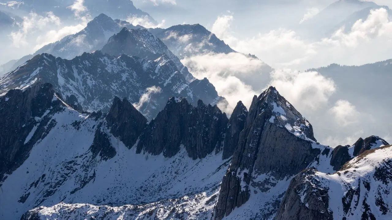
The Kunlun, Karakoram, Tanggula, Gangdise, Nyainqentanglha and Himalayas mountain ranges span the Tibet Autonomous Region from east to west, while the Hengduan Mountain range uniquely winds its way from south to north. Among the fourteen mountains in the world that exceed 8,000 m, five stand in Tibet. Mt. Everest , the world highest, reaches 8844.43 m and allures more and more visitors to admire it yearly, as well as mountaineering expeditions to conquer its summit. Some other peaks, such as Mt. Kailash , although lower in altitude, are noted for their great significance in religious beliefs of the region and are frequented by many hundreds of dedicated pilgrims.
Overview of the Himalayas
The Himalayas, the world’s highest mountain range, form a natural barrier on Tibet’s southern border, stretching across five countries: China (Tibet), Nepal, India, Bhutan, and Pakistan. In Tibet, the Himalayas create an awe-inspiring backdrop of towering peaks and deep valleys. The range plays a crucial role in shaping Tibet’s geography, culture, and climate, and is home to some of the world’s most iconic mountains, including Mount Everest. For travelers, the Tibetan side of the Himalayas offers unique access to remote high-altitude landscapes and sacred pilgrimage sites.
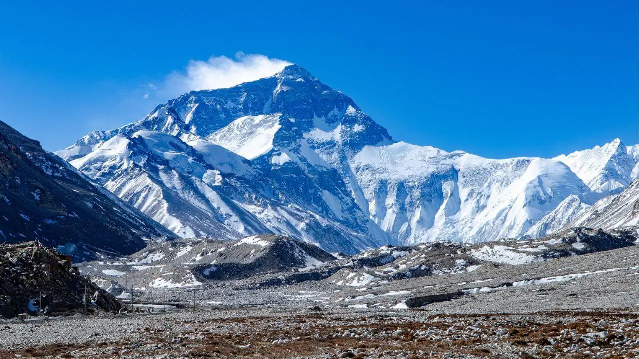
Mount Everest (Qomolangma)
Mount Everest, known as Qomolangma in Tibetan, is the tallest mountain in the world, standing at 8,848.86 meters (29,031.7 feet). It is one of the most popular destinations for travelers visiting Tibet, and the Tibetan side of Everest offers an extraordinary way to experience this legendary peak.
How to Visit Everest Base Camp (EBC) from Tibet
- Travel Route: The journey to EBC from Tibet typically begins in Lhasa or Shigatse. From there, travelers take a scenic drive through Gyantse and Tingri before reaching Rongbuk Monastery, which is the closest settlement to the base camp. The road to EBC is well-paved, allowing for a relatively smooth drive.
- Permit Requirements: Visitors to Everest Base Camp need several permits, including a Tibet Travel Permit, an Alien’s Travel Permit, and a specific permit for the Everest region. These can all be arranged through travel agencies.
- What to Expect at High Altitudes: Everest Base Camp sits at an altitude of 5,200 meters (17,060 feet), so altitude sickness is a real concern for travelers. It’s important to acclimatize gradually, allowing time to rest at lower elevations before making the ascent to EBC. Despite the challenges, travelers are rewarded with stunning views of Everest’s north face and the surrounding Himalayas.
Karakoram Range
To the north of Tibet lies the Karakoram Range, which spans the borders of China, India, and Pakistan. While not as famous as the Himalayas, the Karakoram boasts some of the most challenging and rugged mountain terrain in the world, including K2, the second-highest peak globally.
Nyenchen Tanglha Range
The Nyenchen Tanglha Range, located to the northeast of Lhasa, is often overshadowed by the more famous Himalayan peaks but offers equally stunning beauty and a more serene trekking experience. This lesser-known mountain range is characterized by snow-capped peaks, pristine lakes, and alpine forests, creating a picturesque environment for travelers seeking natural beauty and peaceful treks.
Lakes and Rivers
Rivers in Tibet are not only great in number, but are also recognized as the source of such famous Asian rivers as the Ganges, Mekong and the Indus, etc. The Yarlung Tsangpo River, the fifth longest in China as well as the highest in the world, originates in the Himalayas and flows into India after traveling 2,057 km within China. Rivers of Jinsha, Lancang and Nu, joined by numerous tributaries provide an abundance of hydroelectric energy as well as irrigate the agricultural areas within their floodplain.
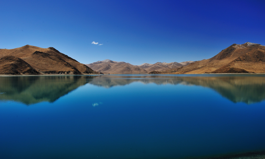
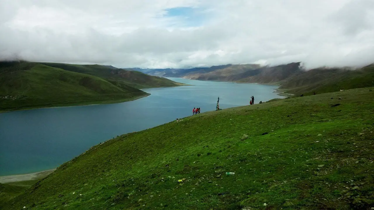
The largest lake in Tibet is Namsto , which, with an area of 1,920 sq km makes it the second largest salt-water lake in China, and, at an altitude of 4,718m the highest salt-water lake in the world. Lake Manasarovar, shares its fame as being one of the ‘Three Holy Lakes in Tibet’ with Namsto and Yamdrok Yumtso , is the highest freshwater lake in the world. With over 1,500 lakes dotted around the vast Tibetan plateau, 47 exceed an area of 100 sq km , with the total surface area being approximately 1/3 of that of China’s lakes.
Deserts and Grasslands
- Changthang Plateau: Features of the Tibetan desert, wildlife (Tibetan antelope, wild yaks), and how to visit
- Nomadic regions: Overview of Tibetan nomadic life on the plateau and grasslands, eco-tourism experiences, tips for visiting nomadic camps
Tibet’s Climate and Weather
Tibet’s climate is characterized by cold, dry conditions, with significant variations between regions. Northern Tibet is colder and more arid, with long winters and minimal precipitation, while Southern Tibet, including Lhasa, experiences milder temperatures and more rainfall during the summer monsoon. Eastern Tibet is more temperate and humid, influenced by the monsoon, resulting in lush vegetation and a more moderate climate.
Seasonal Travel Tips
- Spring (April to June): Mild temperatures and blooming landscapes make this a great time to visit. Expect cool days and cold nights; pack layers and sun protection.
- Summer (July to August): The warmest time, ideal for trekking and visiting high-altitude areas like Mount Everest Base Camp. Be prepared for rain in the south and east during monsoon season with waterproof gear.
- Autumn (September to October): Clear skies and cooler temperatures make this one of the best times to visit Tibet. Great for trekking, with stable weather and spectacular views. Layered clothing is essential.
- Winter (November to March): Harsh cold, especially in the north, but southern areas like Lhasa remain accessible with fewer tourists. Pack heavy winter clothing and prepare for freezing temperatures.
Dressing for Tibet’s Climate
Due to fluctuating temperatures and high altitudes, layering is key. Wear moisture-wicking base layers, insulating middle layers, and windproof, waterproof outer layers. Sunglasses and sunscreen are vital for sun protection, and warm accessories (hats, gloves, scarves) are necessary for cold mornings and evenings. Sturdy footwear is essential for trekking and walking.
Proper preparation ensures a comfortable and safe experience in Tibet’s diverse and extreme climate.
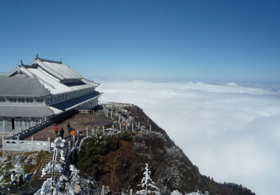
Natural Wonders and Scenic Spots
Tibet is renowned for its breathtaking landscapes, including towering mountains, vast valleys, and ancient glaciers. The region’s natural beauty is unparalleled, offering a range of scenic spots that captivate visitors with dramatic views of snow-capped peaks, serene lakes, and deep river gorges. The combination of high-altitude plateaus and remote wilderness makes Tibet one of the world’s most stunning and awe-inspiring destinations.
Qinghai-Tibet Plateau
The Qinghai-Tibet Plateau, also known as the “Roof of the World,” is a vast and rugged high-altitude region offering incredible scenic drives through remote landscapes. Visitors can explore pristine ecosystems, including high-altitude grasslands, crystal-clear lakes, and unique wildlife like wild yaks and Tibetan antelopes. Recommended routes include the drive from Lhasa to Shigatse, with stops at Yamdrok Lake and along the Yarlung Tsangpo River. To fully experience the plateau, allow time to acclimatize to the high altitude and pack for cold weather.
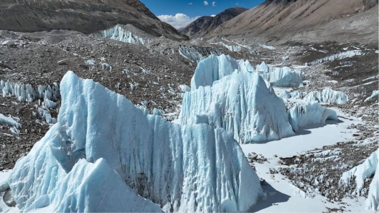
Rongbuk Glacier
Located near Everest Base Camp, the Rongbuk Glacier is one of the most accessible and awe-inspiring glaciers in the world. It offers dramatic views of Mount Everest’s north face and is just a short trek from the base camp. To visit, travelers can stay at the nearby Rongbuk Monastery, the highest monastery in the world, and hike to the glacier, enjoying the stunning contrast of snow-capped peaks and glacial ice. The area is perfect for photography and short walks for visitors seeking an unforgettable Everest experience.
Geographical Challenges for Travelers
Altitude Sickness
Due to Tibet’s extreme elevation, many travelers experience altitude sickness or Acute Mountain Sickness (AMS), which can cause headaches, dizziness, nausea, and fatigue. Symptoms typically appear when ascending above 2,500 meters (8,200 feet), and since much of Tibet sits above 4,000 meters (13,100 feet), it’s a common concern.
Acclimatization Tips
- Rest: Spend your first few days in Lhasa or another lower-altitude area to allow your body to adjust.
- Stay Hydrated: Drink plenty of water and avoid alcohol or strenuous activity.
- Medication: Some travelers take acetazolamide (Diamox) to reduce symptoms, but consult a doctor beforehand. If severe symptoms occur, descending to a lower altitude is crucial for recovery.
Accessibility
Tibet’s remote geography makes transportation challenging, with many roads passing through high mountain passes, rough terrain, and long distances between key locations. Flight connections to Lhasa are common, but overland travel can be time-consuming, especially in more remote regions like Ngari or Mount Kailash.
Travel Planning Tips
- Plan for Extra Time: Journeys between major destinations can take longer than expected due to the terrain and road conditions.
- Hire a Private Vehicle: Renting a car with a local driver is often the best way to explore remote areas.
- Road Conditions: Roads in Tibet can be rough and affected by weather, so be prepared for delays.
Restricted Areas and Permits
Tibet has several restricted regions that require special permits for entry. Foreign travelers cannot visit these areas independently and must go through a registered travel agency to arrange the necessary paperwork. For example:
- Ngari Region (Mount Kailash and Lake Manasarovar) requires a special permit due to its remote location and religious significance.
- Everest Base Camp (EBC) requires an additional permit beyond the standard Tibet Travel Permit.
Travel Regulations
- Always book tours through licensed agencies that can secure the necessary permits.
- Be mindful that travel regulations can change, especially during political or environmental events, which may affect access to certain regions.
Related tours

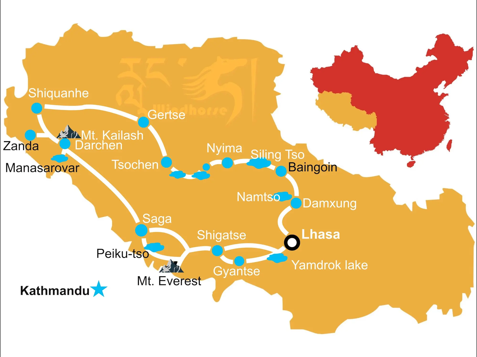


This Mount Kailash and Changthang Overland Loop Tour takes you from Mount Everest, Mount Kailash and Lake Manasarovar to the Guge Kingdom ruins and across the remote Changthang Plateau with snow capped peaks, pristine lakes, vast grasslands, and abundant wildlife.

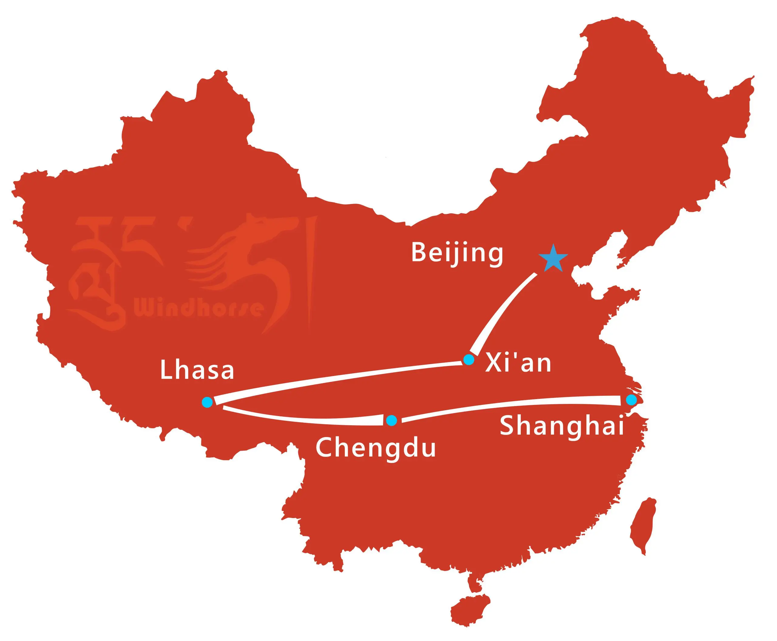


Experience the best of China and Tibet on this 2 week China Tibet Highlights Tour. Visit the Great Wall, Terracotta Army, Potala Palace, and pandas. A perfect mix of history, culture, and nature across Beijing, Xi’an, Lhasa, Chengdu, and Shanghai, perfect for first-time China Tibet travelers.


This 15-day Tibet private tour to Mount Kailash and Everest Base Camp combines spiritual discovery and adventure. Visit Lhasa and Shigatse’s top monasteries, see Mount Everest’s north face, and complete the 3-day Kailash Kora around Mount Kalash, Tibet’s holiest mountain.